Category: community

  • Living Laneways

    Living Laneways
    Turning hidden spaces into climate positive housing solutions

    Greater Sydney has thousands of laneways which are currently underutilised. Fronted primarily by garages or service entries, and often paved with impervious surfaces in need of an upgrade, Living Laneways aims to reconceptualise back lanes as living places which can provide housing, green infrastructure, and social and cultural engagement.

    Laneway revitalisation, greening, activation, safety and/or housing has been implemented in Australia, as well as internationally. Living Laneways proposes to incorporate lessons from a variety of these case studies, bringing together community members, government agencies, subject matter experts, and other stakeholders to compile a collaborative approach to making laneways great places to live: building laneway housing while also creating green, cool, and water sensitive lanes.

    Laneway housing, greening, and revitalisation are not new ideas. For example, Vancouver and Toronto have established laneway housing as a solution to increasing density and affordable housing options in the centre city. Chicago has a long-standing program, Green Alleys, to improve stormwater drainage, reduce heat, and conserve energy through permeable paving, recycled materials, and more efficient lighting. Melbourne’s Green Your Laneway program and the City of Sydney and other LGAs, such as Burwood and the Inner West, as well as community groups, are working to green and revitalise laneways through a variety of techniques. Laneway housing, termed secondary dwellings or granny flats, has been built in Sydney by architects, planners, builders, and residents, navigating an often complex set of regulations and processes depending on the LGA, lot size, zone, heritage designation, and other requirements. Please check out our collaborative online map of laneway projects in Sydney (and get in touch with us at the email below to add more!)

    Living Laneways aims to bring together and learn from the approaches and outcomes of these policies and projects, enabling more Sydney LGAs, businesses, and residents to take collaborative, place-based action in their own neighbourhoods and with their own properties. This is particularly important along residential laneways, where innovative and harmonised solutions are required to create vibrant, resilient, and liveable lanes.
    Living Laneways
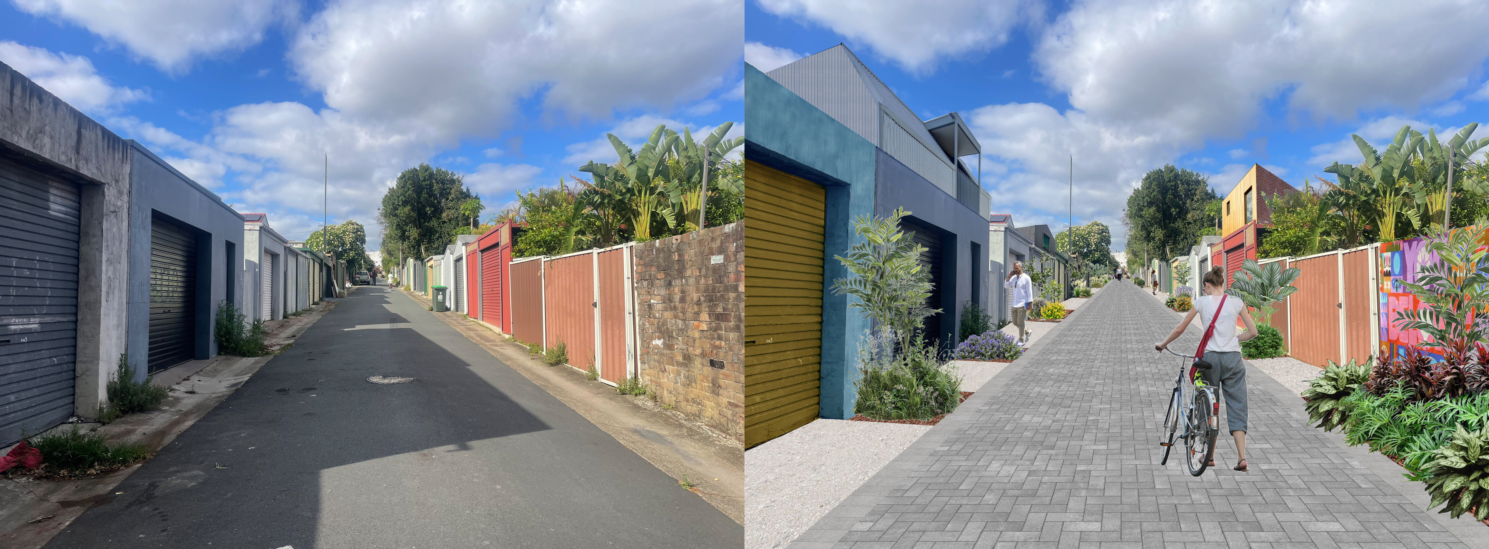
    Potential incremental transformation of a typical residential laneway in Sydney. Before (left) and after (right). Image credit: Bing Han and Living Laneways.

    Living Laneways has several overlapping stages:
    – Learning from case studies in cities such as: Sydney, Melbourne, Toronto, Vancouver, Chicago, etc.
    – Place-based zoning, policy, regulation, and approval requirements analysis, identifying potential locations, challenges, opportunities, and possibilities for harmonisation across state and local government
    – Developing a strategic vision for Living Laneways Greater Sydney
    – Community consultation and participation at all stages
    – Advocating for local and state government, as well as residential, small business, industrial and commercial stakeholders, to participate, fund, and construct Living Laneways (e.g. through grants, in kind donations, tax incentives, advocacy and/or sponsorships).

    We are actively looking for collaborators, whether through: promoting and sharing information about your project(s) and experience through our online map and References and Resources list (see below); collaborating on research and engagement; and/or through funding, partnership, and sponsorship. Please contact melissa@transversestudio.com to connect and get involved!

    References and Resources(list in progress!)
    Laneway Housing – examples & planning information
    Laneway Twins, Gadigal Country, Hill Thalis
    Redfern Studio, McGregor Westlake Architecture
    Small House, Surry Hills, Dominic Alvaro Architect (exciting example of a place-responsive, multi-storey small lot dwelling)
    St. Peters House II, Kries Grennan Architecture

    NSW Planning, Housing SEPP: Secondary Dwellings (Granny Flats) information
    Guidance on NSW Low- and mid-rise (LMR) housing provided by Planland

    Laneway Greening – examples, policies & programs
    Carnegie Community Laneways, Melbourne
    Greening Sydney Strategy, City of Sydney (pg 42 – Green our laneways)
    Green Your Laneway program, City of Melbourne

    Laneway Activation, Revitalisation & Placemaking – examples, policies, studies & programs
    City of Sydney Laneways Revitalisation Plan (2021 announcement)
    Lanes and alleyways of Sydney (Wikipedia page mostly about City of Sydney laneways)
    CBD Revitalisation—The Relationship Between Laneway Activation and Sense of Place, study by Brittany Hughes
    Geelong Laneways, Aspect Studios
    Quay Quarter / Loftus Lanes, City of Sydney, Aspect Studios More info & full project team
    Fish Lane Arts Precinct, Ulster Lane, Eden Laneway, Brisbane, Aria Property Group, with RPS, Richards and Spence Architects (Fish Lane), Cameron and Co. (Ulster), and Rothelowman (Eden).

    Other References & Resources
    The Laneway Project – Toronto based laneway revitalisation organisation (an inspiration and model for Living Laneways!)
    RE-IMAGINING LANEWAYS IN TORONTO, article by architect Dean Goodman in Spacing Magazine
    NSW Movement and Place design principles – Residential Lanes and Service Lanes
    Chicago’s Green Alley Handbook
    Permeable Paving – one example and technical details guide (for reference only)
    Your garage might be the most underrated room in the city – article by Jeffery Tompkins about the multifunctional potential of laneways and garages (US context – great case study and lessons for AUS)
    Living Laneways
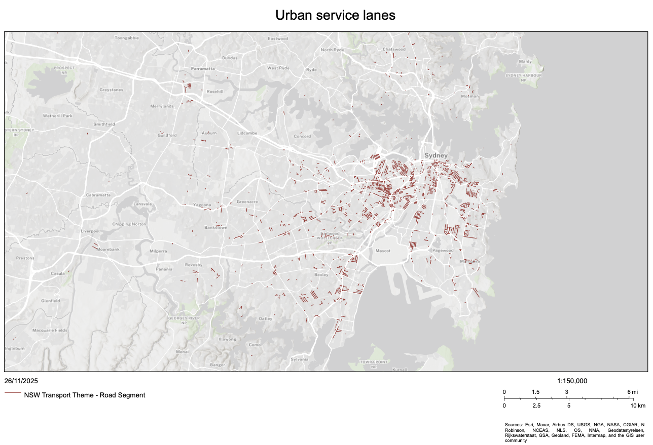
    Initial mapping of Urban Service Lanes in Sydney, 2025. Future mapping proposed to include other laneway types, with place-based analysis potential for Living LanewaysImage credit: SDT Explorer, © State of New South Wales.
  • building urban resilience

    City interior as hybrid landscape:
    Building urban resilience through green, blue and socio-cultural infrastructures

    Year 3, BA(Hons) in Design, Environment and Interiors
    School of Design, HK PolyU
    Semester 2, 2018
    Unit Leader: Melissa Cate Christ

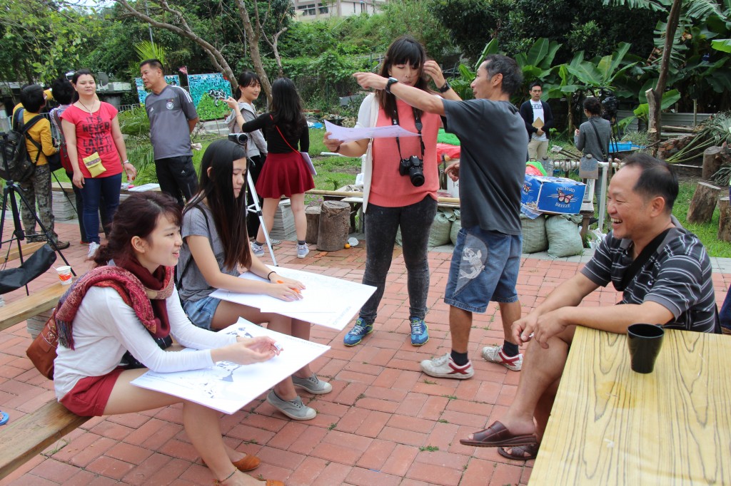
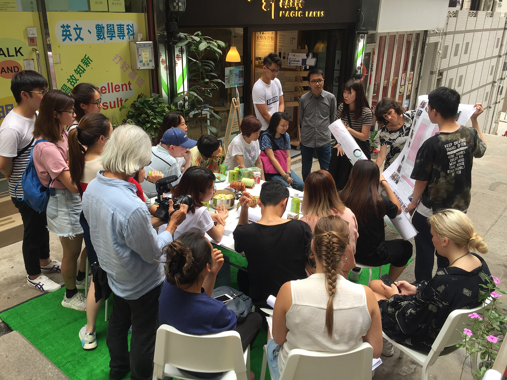
    building urban resilienceCo-design workshop at Magic Lanes with residents and students of Chinese University of Hong Kong and the Hong Kong Polytechnic University, 2018. Image credit: Hendrik Tieben.
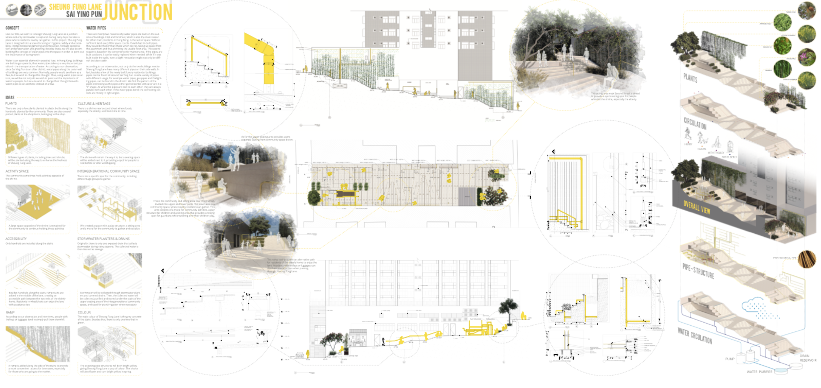
    In this studio unit with 3rd year undergraduate students in Environment and Interiors Design, students learned about, tested and designed with key concepts and strategies employed in landscape architecture. This was done through engaging in a real-world, collaborative, community engagement, research, and design project in an alley stair in Sai Ying Pun, HK. Students were introduced to fundamental principles, elements and practices of landscape design and research. They utilized these skills to engage in site and detail design of blue, green, and social-cultural infrastructures in consultation with stakeholders and the general public through a community workshop and in final design reviews with site stakeholders. All projects were asked to address these five issues with respect to stakeholders and the site: 1)Hygiene; 2)Safety and Accessibility; 3) Intergenerational gathering and interaction; 4) Heritage conservation and preservation; and 5) Greening/ecosystem services/ecological function. For more information on the context of this project, please see the book chapter ‘Magic Lanes : A placemaking approach for laneway spaces in Hong Kong‘, co-written with Hendrik Tieben. The community engagement portion of this studio was conducted in collaboration with Henrik Tieben’s Chinese University of Hong Kong Urban Design Studio and Caritas as part of/adjacent to the URF funded project ‘Magic Lanes’.
    building urban resilience
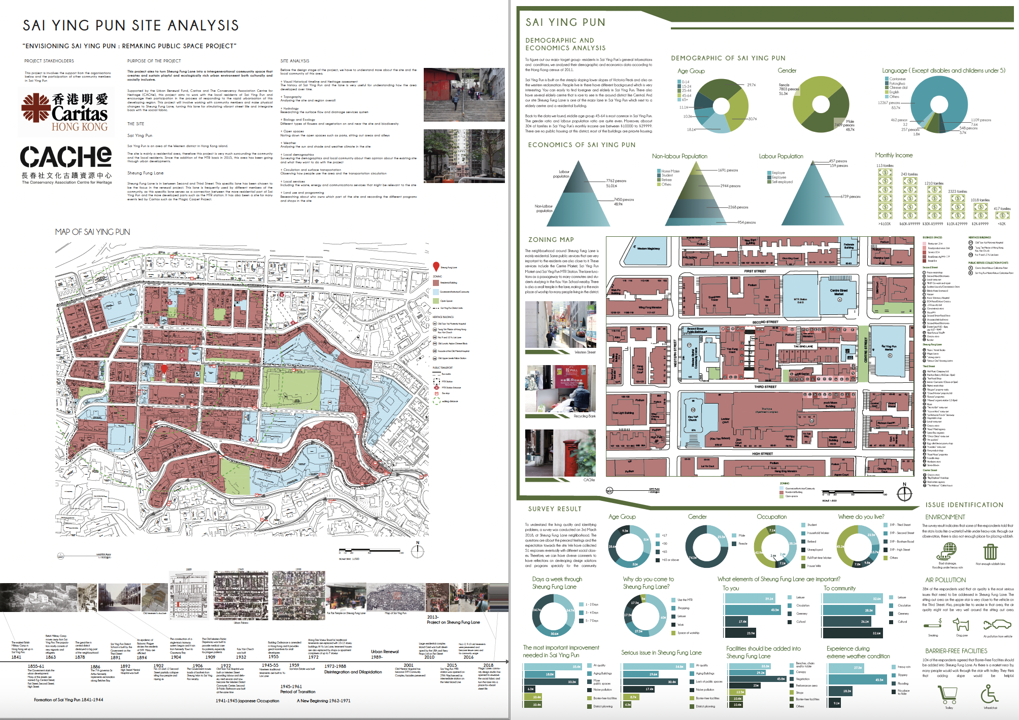
    A selection of the student site and contextual research on Sai Ying Pun and Sheung Fung Lane. Image credits: SD3562 E&I students Term 2 2018.

    building urban resilience
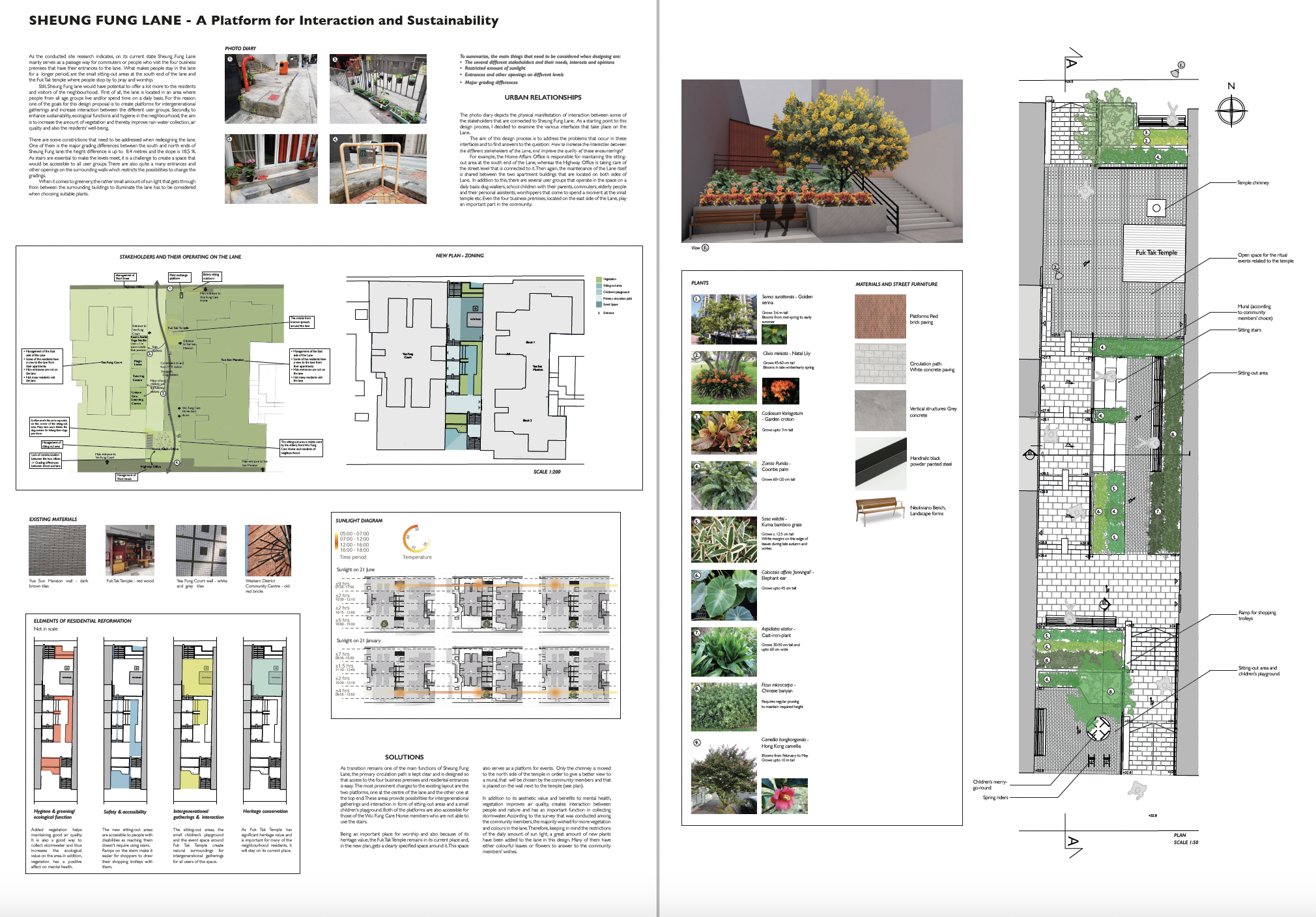
    Mira’s project provided a minimal yet elegant intervention to address basic community feedback around sustainability and interaction. It was the starting point for the design that was later developed by Caritas and Magic Lanes. Image credit: Mirą, PolyU School of Design 2018.

    building urban resilience
    Rebecca and Lucas’s project envisioned a playful and colourful renovation which Image credit: Yu Pui Man and Kwok Chin Fung, PolyU School of Design 2018

    Background and rationale from the studio brief:
    When considering the “interiority” of the city, in particular the city of Hong Kong, it is crucial to develop tools and methods to understand, represent, and design landscapes. As our global cities attract bigger populations, demand is increasing for materials, energy, and infrastructure. Urban migration and sprawl, post industrial sites, informal settlements, and a rising number and intensity of disaster events endanger communities and strain financial and human resources. Issues of food security, bio-diversity, climate change, cultural heritage preservation, and waste and water management are becoming ever more urgent. Although global in scope, these issues require local, collaborative, community-based action that realizes existing resources, influences policy, and conditions municipal, regional and global plans. Designers can play key roles in these situations, engaging and educating environmentally aware residents and policy makers, creating dynamic public places, and facilitating solutions such as activated hybrid downtown neighborhoods and streets, reclaimed rooftops, brownfields, and vacant land, and ecologically and socio-culturally resilient and efficient basic amenities, services, and landscapes.

    Defining landscape as a type of public infrastructure, landscape can be understood as the totality of exterior environments that shape experience. In this “expanded field”, landscape practice endeavors to observe, analyze, define, and design for changing typologies of public and private space, proposing strategies and tactics that engage people in the active experience of place. Context and site, materials and systems, community involvement, maintenance, and multifunction are essential factors which can maximize the potential for city “interior” exterior spaces to become places of ecological and socio-cultural value. It is through a critical and hands-on engagement with the networks of processes (ecological, socio-cultural, operational, geo-political, economic…)
    that compose and determine the urban, regional, and global landscape, that design action can uncover solutions, create great places, and instigate dialogue about the future of our environment and the way we live.

    Keywords: constructed ecologies; landscape performance; landscape systems; green/blue/grey/socio-cultural infrastructure; ecosystem services; grading/site engineering; accessibility; groundwater; storm water; runoff; ground/soil; sun/shade; flexible programming; political, social and cultural uses; circulation; space
    and time; green streets, roofs and walls; canopies; seating; drainage; vegetation; paving; railings.

  • view archive / archive view

    July 6, 2013
    viewing the archive / archiving the view
    Asia Art Archive Open Weekend

    Andrew Toland and Melissa Cate Christ were invited by the AAA to hold a workshop during Open Weekend which served as a participatory record of the AAA’s current space, employees and visitors. The workshop offered the public an opportunity to experience how designers document spatial conditions and experiences using the space of the AAA and its surroundings. Through a structured process, participants took on the roles of designer, artist, storyteller and archivist to create a visual narrative about the Archive and its immediate context in order to archive past, present and future stories in Sheung Wan.

    More info about Open Weekend and other events here.


  • alternate constructions

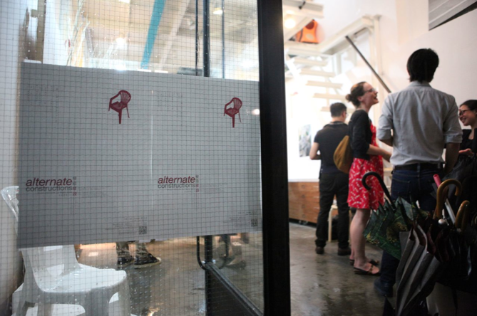
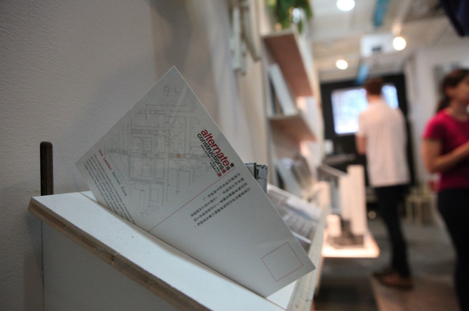
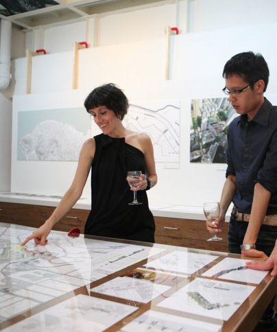
    alternate constructions: Stair culture in Hong Kong
    June 14-21, 2013
    11am-7pm daily
    Opening reception: June 14, 6-9pm
    Mapping workshop: June 15, 2-4pm
    TopZoo, 66 Po Hing Fong, Sheung Wan

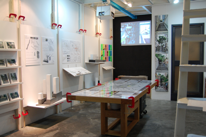
    The exhibition features the design research of HKU students and faculty in the context of the proposed escalator along Pound Lane.
    Organized by Melissa Cate Christ
    Exhibition design by Andrew Toland
    Supported by the Division of Landscape Architecture, University of Hong Kong and the Knowledge Exchange Fund.

    More info and images from the exhibition at an escalator for pound lane? and stairculture.com.
    Press statement and exhibition specs here.


  • in the know

    February 2, 2013
    in the know: experiments in spatial memory

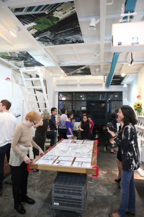
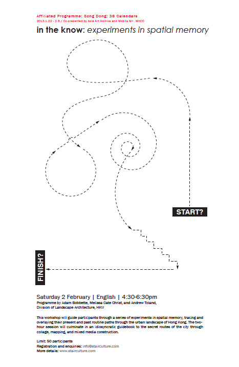
    At the invitation of the Asia Art Archive, Andrew Toland, Adam Bobbette and Melissa Cate Christ organized a workshop as part of Song Dong’s new exhibition, 36 Calandars, at ArtisTree, TaiKoo Place, HK. The workshop guided participants through a series of experiments in spatial memory, tracing and overlaying their present and past routine paths through the urban landscape of Hong Kong. The two hour session evidenced an idiosyncratic demonstration of the secret routes of the city through collage, mapping, and mixed media construction.

    More info on the Song Dong exhibition and other affiliated programmes here.
    A selection of photos from the workshop can be found here.
    in the know
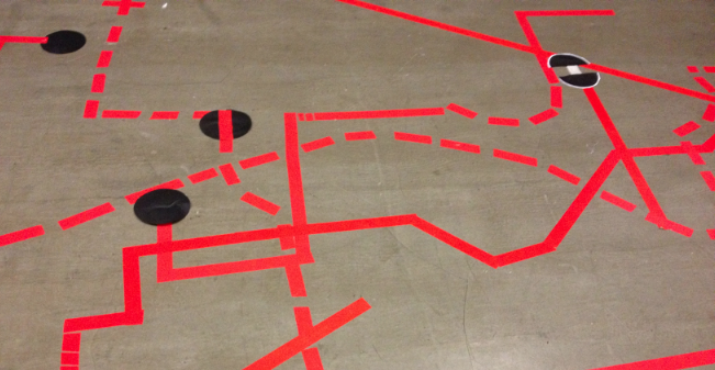
    participant memory path intersections and overlays @ in the know, feb 2, 2013
    in the know

  • envisioning pokfulam village

    Envisioning Pokfulam Village
    Strategies of engagement and intervention in complex urban communities
    BALS2 Fall 2013 ▪ ARCH 2043 Landscape Design Studio II: Site and Community
    Instructors: Melissa Cate Christ and Seth Denizen

    The collected work of the studio, including documentation of the workshop executed as part of ARCH2041 Environment Community and Design, can be found at pokfulamvillage.com

    envisioning pokfulam village
    Sun Chang Lo, Pokfulam Village, Hong Kong, 1996

    From the course syllabus & final project brief:
    This studio looks at the relationship between site and community by asking how landscapes and lives are assembled. How can the relationship between people’s lives and the infrastructure of living be addressed by landscape architecture? Further, and perhaps most fundamentally, the studio asks how a landscape can shape the way we live.

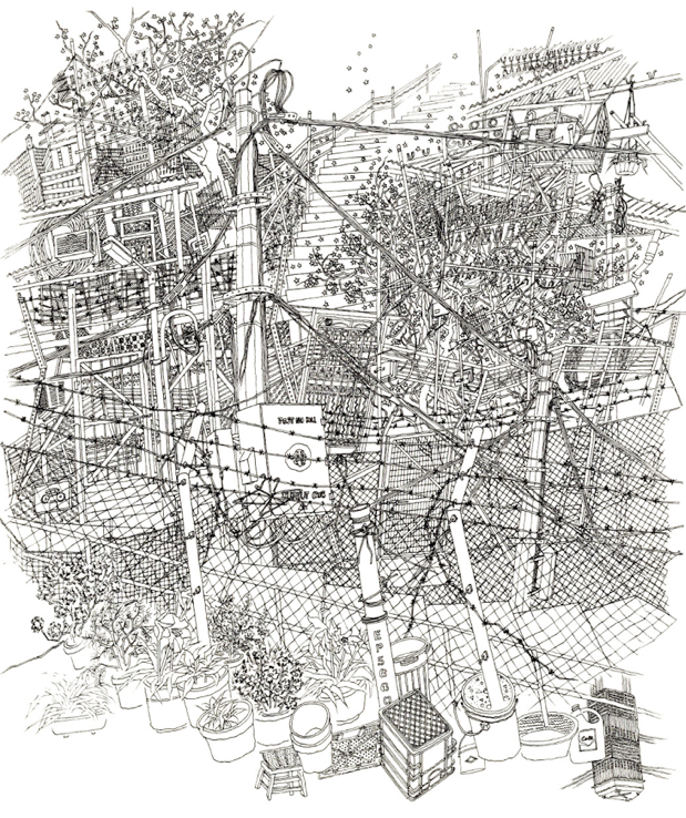
    Framed by these questions, the studio proposes to look at the assemblage of site and community relations in Pokfulam Village. In the original land allocation and layout of the village, each Hakka row house was allocated a plot of land to farm. As the population increased, many of the plots were leased and/or developed for non-formalized housing, leading a complex of different types of land tenure. In addition the 1982 Squatter Control Policy restricted the ability of residents to improve their homes, leading to the perception that the village is an urban slum due to its primary building material, metal sheeting, densely packed urban structure, and lack of basic sewage infrastructure. Ironically the Squatter Control Policy, combined with Pokfulam Road moratorium, has led to the preservation of the village, if only that it has not be redeveloped into high rise housing as much of the adjacent land has been. But with recent calls to lift the moratorium, community efforts to raise the profile of the village and to acknowledge its heritage value has led to it’s listing as a threatened site on the World Monuments Fund Watch list, raising the question of how to improve the living environment and accessibility of the village without losing its unque character and sense of community. In this context, the studio will explore the capacity and resilience of the village: what infrastructures, maintenance regimes and/or social practices can be embedded in the village and how would they be deployed and configured?

    In order to answer this question, the studio is composed of a series of cumulative exercises. The first studio exercise asks students to uncover an essential element of the village through their own observations – documenting a phenomena, element, process or idea in the form of a photo diary and short text. The second exercise examines the village’s current food supply and demand through the production of measured orthographic drawings of the village’s markets. The third exercise of the studio asks students to produced detailed maps of the ground materials and systems of the village, integrating the first two exercises and laying the foundation for the final design project. The final exercise of the studio asks students to layout a strategy and site design which addresses an issue or problem identified in their system/network mapping.

    Each exercise of the studio can be seen as a different way to explore the same fundamental questions: how landscapes and lives are assembled, how landscape shapes our lives, and how we shape the landscape. To that end, the studio exercises will be conducted in consultation with the local community through engagement exercises designed and executed by the students in the concurrent course, Environment Community and Design.

    Envisioning Pokfulam Village workshop, November 10, 2013
    envisioning pokfulam village
    How do we design in Pokfulam Village?
    The first step to answering the question of how to act is to define our role. Pokfulam is a city of designers. Almost everything in Pokfulam is hand-made, down to the pipes and infrastructure that form the most essential core of the urban environment. This throws our role into question: should we replace them as designers of their city? Are we better or worse designers than they are? How can we design from the top-down in a place that is built bottom-up?

    In order to formulate a coherent response to these questions we must think about the process of design as a partnership with the world, a process of becoming entangled in people’s problems and desires. In the community workshop, we will engage in the process of building this partnership in order to further entangle ourselves and our work with the problems and desires of Pokfulam. Another part of defining our role is to think strategically. For instance, the majority of the architectural problems in Pokfulam arise precisely at the moment when the scale of the problem exceeds the scale of a single home or single piece of property. In other words, problems do not get fixed when it’s not clear whose problem it is, or who is allowed to design a solution. Pokfulam is not the result of a single vision, but rather of hundreds of visions that have all been tightly and tragically constrained by legal frameworks.

    Based on these considerations, our role then is to identify opportunities for interventions that address this scale – the problems that too large for the average resident to address by themselves. This will allow us to reimagine the parts of Pokfulam that no one has previously had the opportunity to address. For example, no one has had the opportunity to reimagine how to use the fragmented shards of space expropriated and fenced in by the government, but we can do this quite easily. No one has had the opportunity to consider the diverse kinds of public and semipublic space in Pokfulam as a single system, but this is also something we can do through our design proposals.

    Our role is to provide solutions to Pokfulam’s problems that reimagine the future of the village – to provide alternatives to the impending destruction and displacement that is threatening the village and its residents.

  • environment community & design

    Environment Community and Design
    BALS3 2011-2013 – Arch 3029

    This course was an applied research seminar in the Bachelor of Landscape Studies program in the Division of Landscape Architecture, University of Hong Kong.
    environment community & design
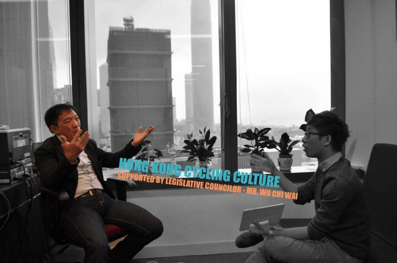
    Still from ‘Ride with me, Ride the Breeze’, a short documentary about the debate over a grassroots proposal to build a bike path along the northern edge of HK Island. The project was developed by 2012 ECD students Joshua LEUNG Lik Heng, Tamsin THORNBURROW, Yvonne MENG and Macy CHUNG Mei Sai.

    The course explores the complexity and interaction between urban environments and their communities, as well as the role of agency in design practice. It includes local and international research and case studies that demonstrate typologies of landscape formation, process and meaning. The course also includes a review of methods of community engagement, both formal and informal, as well as engaging students in ‘real world’ community issues , in particular the investigation of local community environments faced with the possibility major transformation through the development and construction of significant infrastructure.

    The primary focus of the engagement exercises of the 2011 iteration of the course was the escalator proposed for Pound Lane. The collected work can be found here. The projects and workshop were supported by the Faculty of Landscape Architecture and an HKU KE grant.

    The 2012 iteration of the course asked the students to investigate and engage in a contemporary issue in Hong Kong related to infrastructure development and its community impacts. The collected work of the course can be found here. The development of the framework of the course and the student projects were supported by an HKU Teaching Development Grant.

    The primary focus of the engagement exercises of the 2013 iteration of the course was the future of Pokfulam Village in the context of development pressures, heritage conservation and the lack of proper sanitary services in the village. The course worked in tandem with the student’s studio, also taught by Melissa Cate Christ (in collaboration with Seth Denizen). The collected work of both courses can be found at pokfulamvillage.com.

  • save our wading pool!

    Open our Wading Pool!
    2011
    With the support of the Leschi and Madrona community councils, and mom’s groups, the co-op at Central Community College, Seattle Parks and Rec, and numerous other community members and parents.
    save our wading pool!
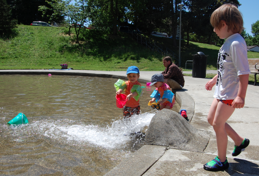
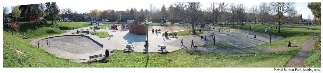
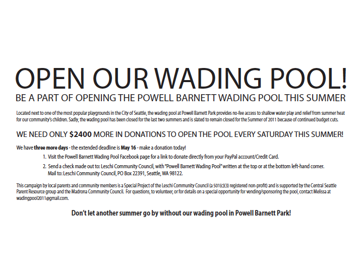
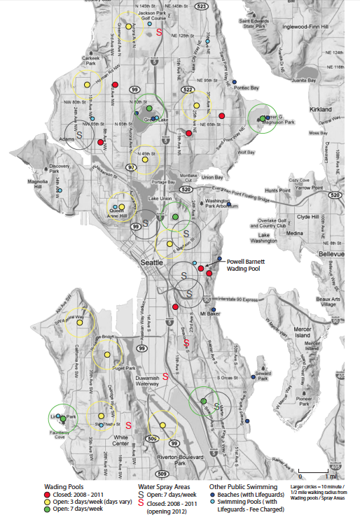
    Implemented in Spring/Summer 2011, “Open our Wading Pool!” is a community-sourced project to reopen the Powell Barnett Park wading pool, located in the Central District (CD) neighborhood of Seattle. Initiated by Melissa Cate Christ and executed in collaboration with a network of community groups and municipal departments, the project re-activated a public space whose operation had been abandoned due to budget cuts. Through a series of events, poster campaigns, and grassroots outreach activities, an incremental engagement and empowerment of the local community was enacted, allowing the temporary occupation of an often overlooked but crucial public amenity, the humble wading pool.
    save our wading pool!
    Historically neglected, Powell Barnett (PB) Park was the site of a Starbucks-sponsored BOOM makeover in 2006 , transforming the 40 year old legacy of a community leader into a “destination park” which serves an ethnically and economically diverse range of Seattle residents and visitors. Despite the huge popularity of the park, the PB wading pool, a crucial summer component of a park/playground in full sun, was closed in 2009 and 2010 due to city budget cuts.
    save our wading pool!
    Led by Melissa, as both a landscape architect and a CD resident (with two toddlers), the project began as advocacy research into the neglected concrete basin in PB park. Over time, it became a grassroots, event-staging, outreach and fundraising effort which was able to successfully negotiate the opening of the PB wading pool on a weekly basis for the summer of 2011.

    Supported by local community groups, the project consisted of a poster campaign, followed by the establishment of an online presence through a Public Places Facebook page and on the local blogs the CD news and the Madrona neighborhood blog.

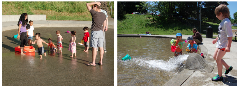
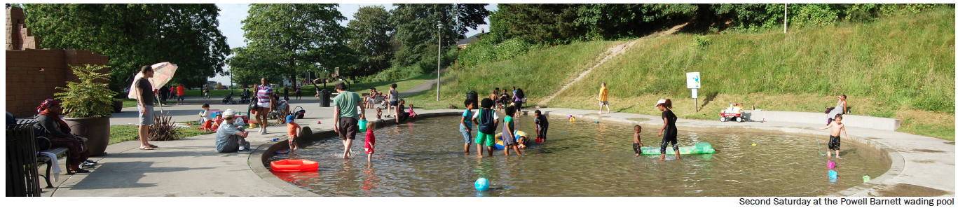
    The project staged a series of events: a “Wade-In” where we occupied the empty pool (the stars aligned for 65 and sunny in May – a near miracle in Seattle!) to raise awareness about the value of the currently squandered park space, and a fundraiser at a local pizza place (the owner’s son had splashed in the pool in previous years). In the end, eight Saturdays were funded through the raising of $4400 with over 60 donors, the majority of which were between $10-$50. Each open day was an event in itself, with BBQ’s, pool toys, music and high attendance. Average numbers were recorded at 169/day, putting the PB Wading Pool in the top five for average daily attendance. Due to a cool summer, the season was extended by two weeks across Seattle, fulfilling Parks and Rec’s commitment to us to open the PB pool for eight days and a sign that the City has begun to understand the cultural value of these humble concrete basins.
    save our wading pool!save our wading pool!

    Spring 2012 update: On the heels of our success last summer, we plan to lobby for a more equitable distribution of city funding to spread the open days at pools across the city (rather than in 3 or 7 day clusters) so that the burden of private fundraising can be reduced/shared across the wading pool user base. Eventually, we want to see a shift away from building new spray parks and towards supporting and preserving the existing wading pools, many of which have been serving the community for 50+ years.
    save our wading pool!
    Summer 2012 update: Through a marketing campaign by ask.com, Powell Barnett Wading Pool was once again open Saturdays throughout the summer.
    Summer 2013 Update : Lacking a sustainable funding model, Powell Barnett Wading Pool did not open during the summer of 2013.
    Summer 2014 update: Seattle Parks and Recreation open a Facebook page just for Wading Pools and Spray parks!

  • mapPokfulam

    May 3, 2015
    #MapPokfulam project featured on TVB’s Sunday Report
    (in Cantonese)

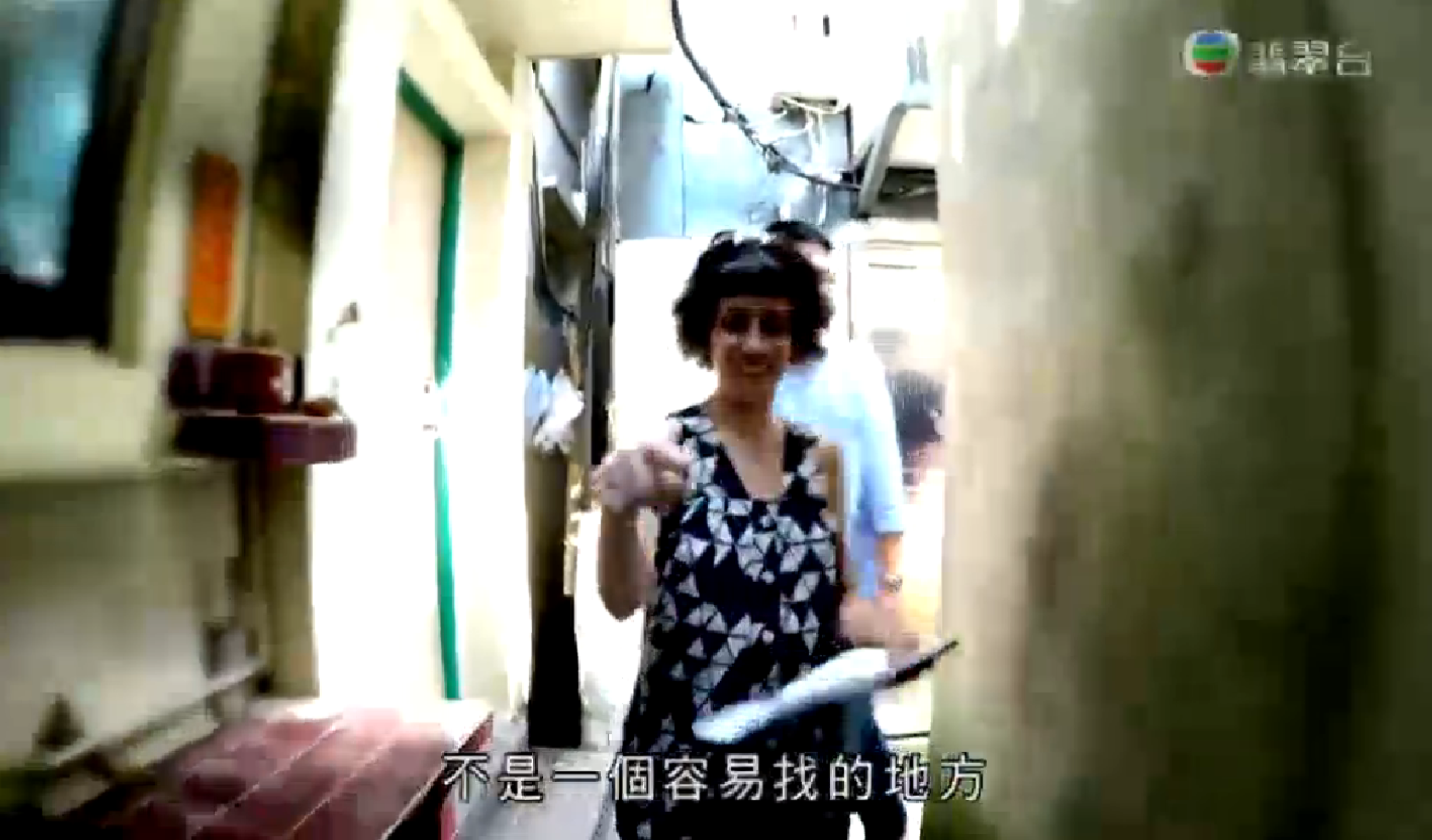
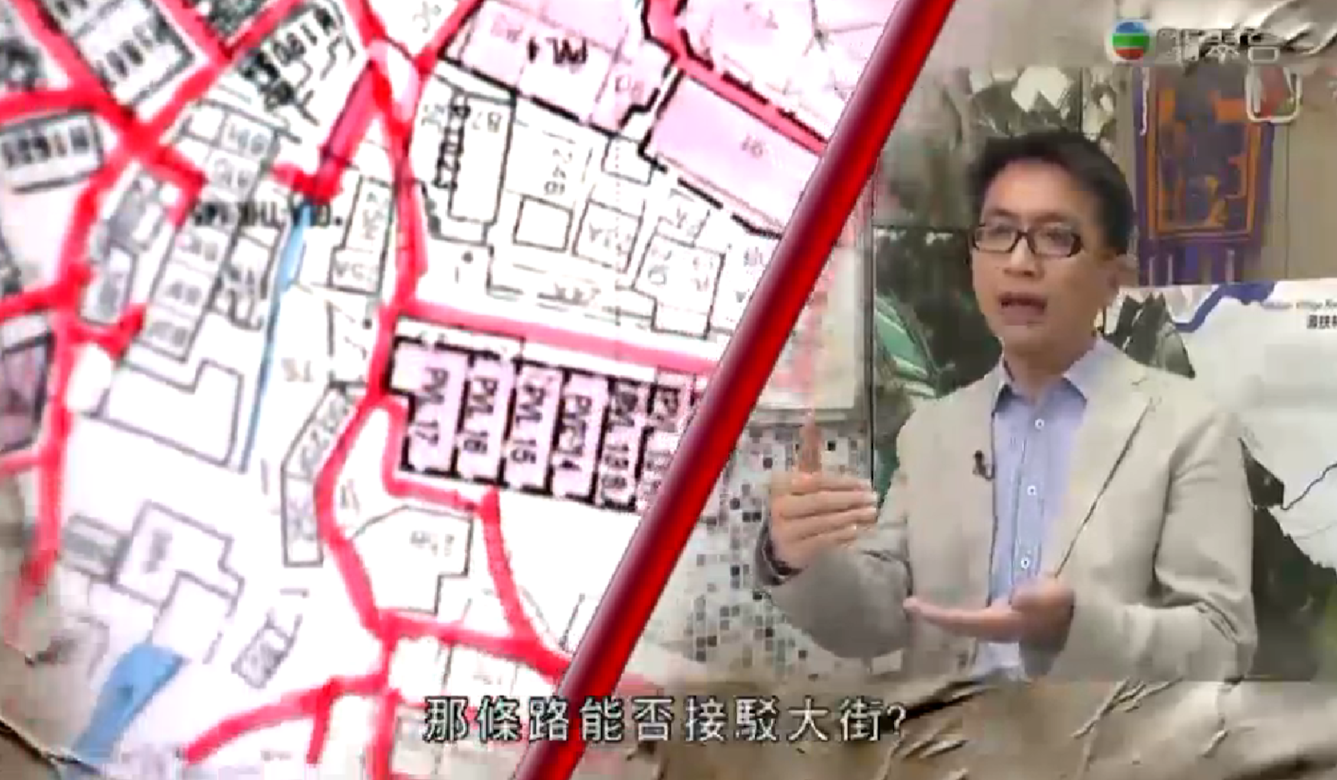
    Our MapPokfulam project has been featured on the most recent episode of the TVB program Sunday Report. The program focuses on three community / grassroots mapping projects in Hong Kong and includes an interview with Melissa and Benjamin Sin. See the program here. mapPokfulammapPokfulam
    This community mapping project is supported by the Hong Kong Southern District Council and the Southern District Health and Safety Association in collaboration with Caritas and the Pokfulam Village Cultural Landscape Conservation Group, Pokfulam Villagers and university students.

    March 8, 2015
    #MapPokfulam: System Prototype Demo & Testing Workshop
    Sunday March 8, 2-4pm
    Old Restaurant, Main Street, Pokfulam Village

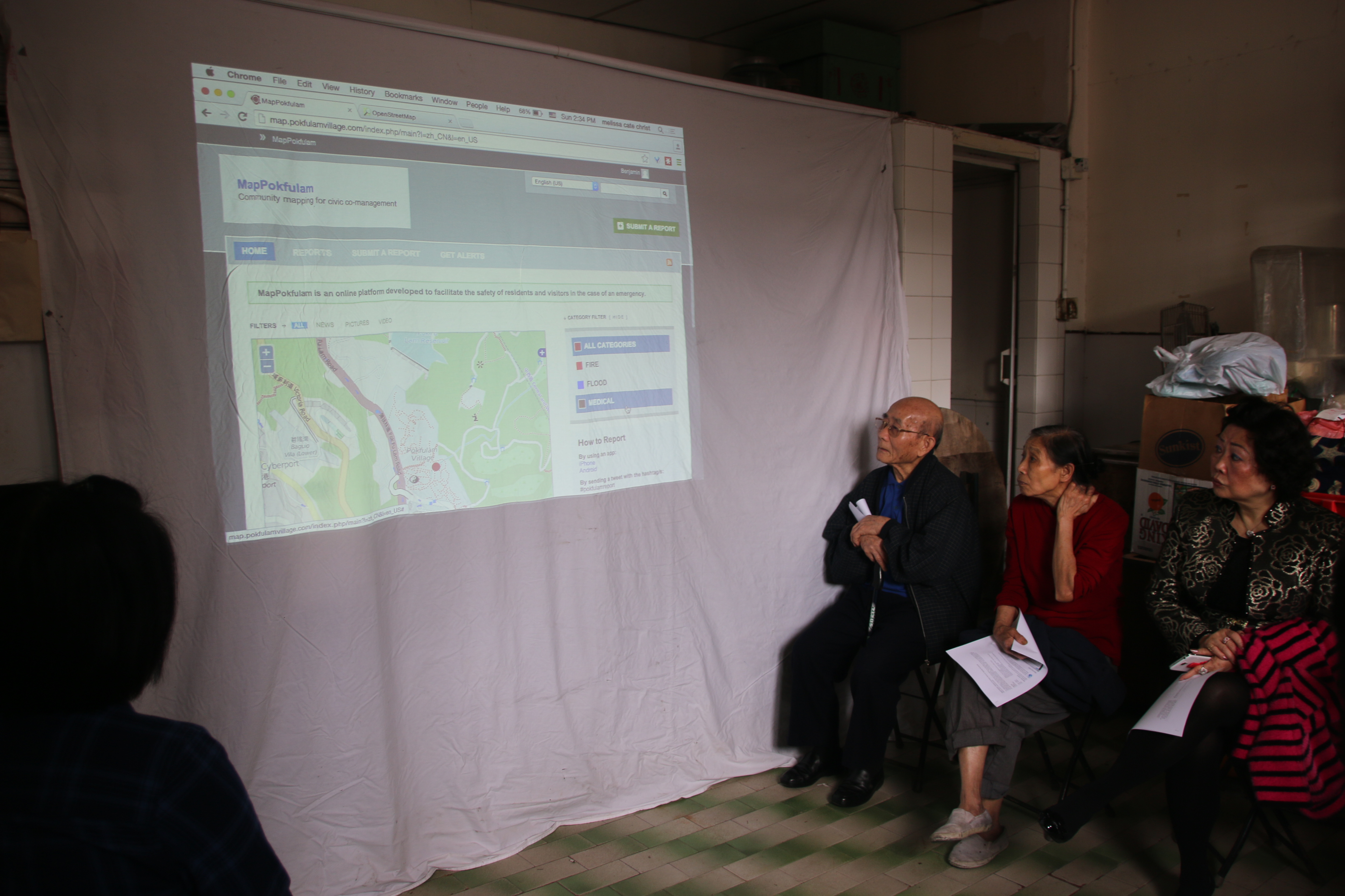
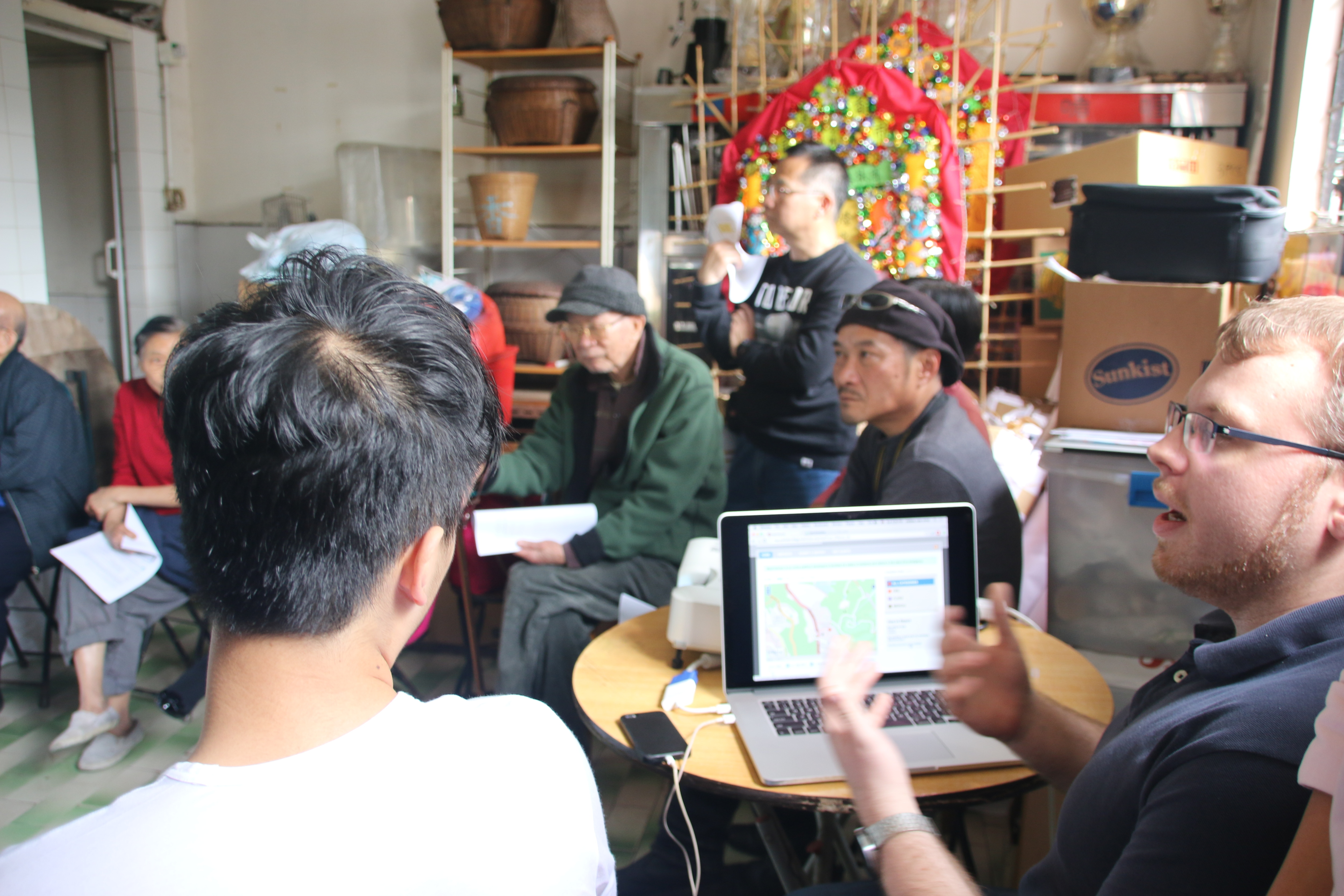
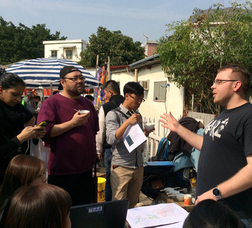
    The “MapPokfulam” Project develops a online platform for information exchange to facilitate the safety of residents and villagers in the case of an emergency. The first step of this process was mapping the village using the free and open source mapping platform Open Street Map. Please join us for a demonstration and testing of how to make a report using the Ushahidi platform and give your feedback as to the utility of the system and what else needs to be included in the map and the system itself. Check out the prototype at http://map.pokfulamvillage.com/
    mapPokfulammapPokfulam
    This community mapping project is supported by the Hong Kong Southern District Council and the Southern District Health and Safety Association in collaboration with Caritas and the Pokfulam Village Cultural Landscape Conservation Group, Pokfulam Villagers and university students.

    February 8, 2015
    #MapPokfulam Open Street Mapping workshop
    Sunday, February 8, 2-4pm
    Pokfulam Village Community plaza

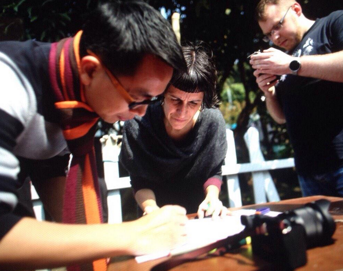
    The “MapPokfulam” project develops a online platform for information exchange to facilitate the safety of villagers in the case of an emergency. The first step of this process is mapping the village using the free and open source mapping platform Open Street Map. Please join us for the first community workshop to learn how to take and upload tracings in OSM, as well add key features and points and edit the online map.
    Image credit: Jerome Favre/EPAmapPokfulammapPokfulam

  • roof painting in pokfulam village

    January 25 & 26, 2014
    Roof Painting in Pokfulam Village
    Designed by Melissa Cate Christ & Seth Denizen in collaboration with BALS3 students, and coordinated and supported by the Pokfulam Village Cultural Landscape Conservation Group, the Gallant Ho Experiential Learning Centre and the WAY Fund.


    From the project’s Press Release:
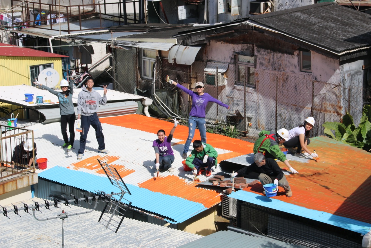
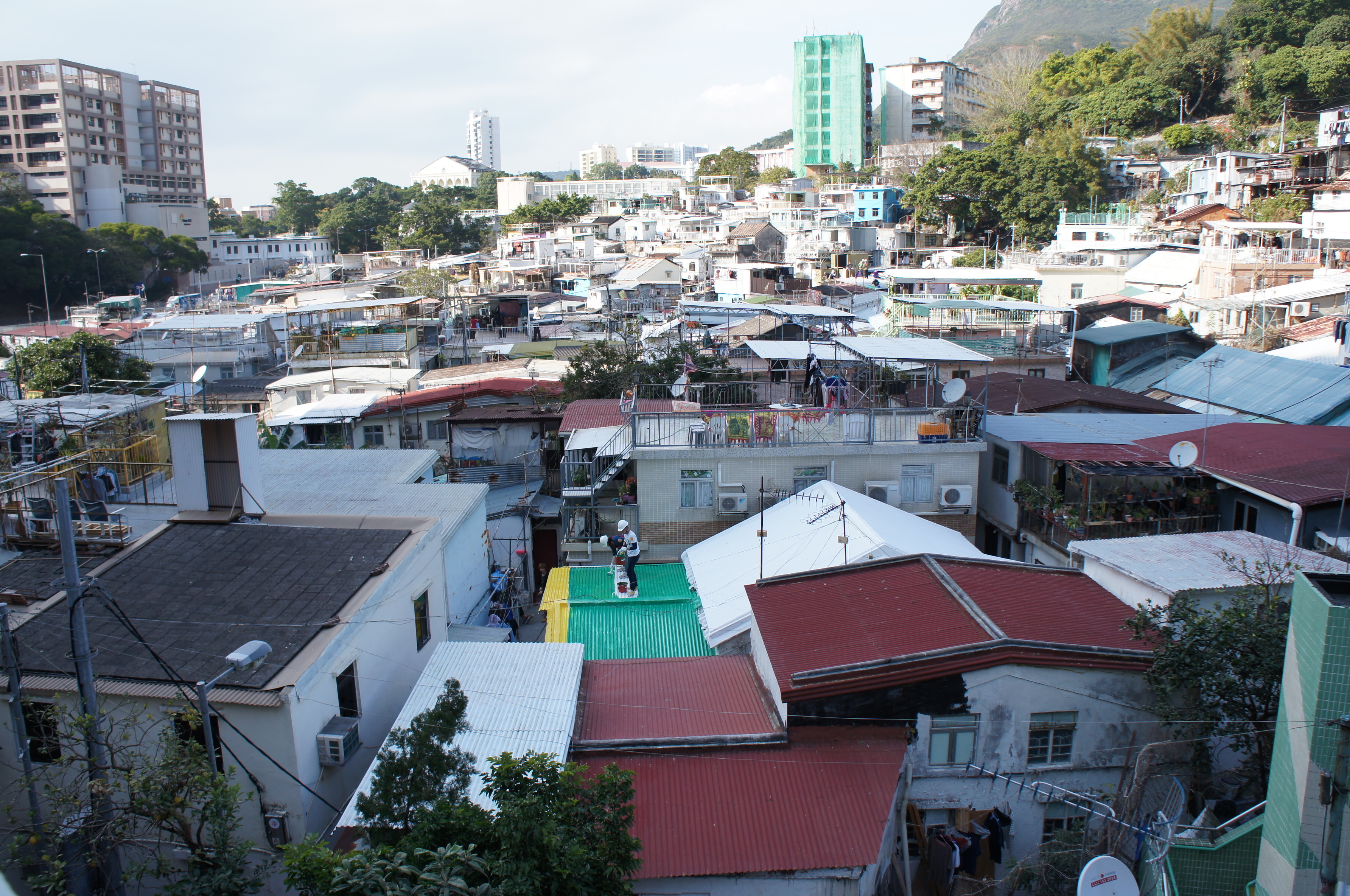
    On the weekend of January 25th and 26th, 174 students from the University of Hong Kong (HKU) painted 50 rooftops in Pokfulam Village. Designed by HKU Landscape Architecture professors Melissa Cate Christ and Seth Denizen based on site and visual research gathered by their team of Bachelor of Landscape Architecture student research assistants and in collaboration with villagers, the project aimed to support the Pokfulam Village Landscape Conservation Group and the Caritas Pokfulam Community Development Project’s efforts to co-build a sustainable community and advocate for the re-evaluation of the existing Squatter Control Policy.

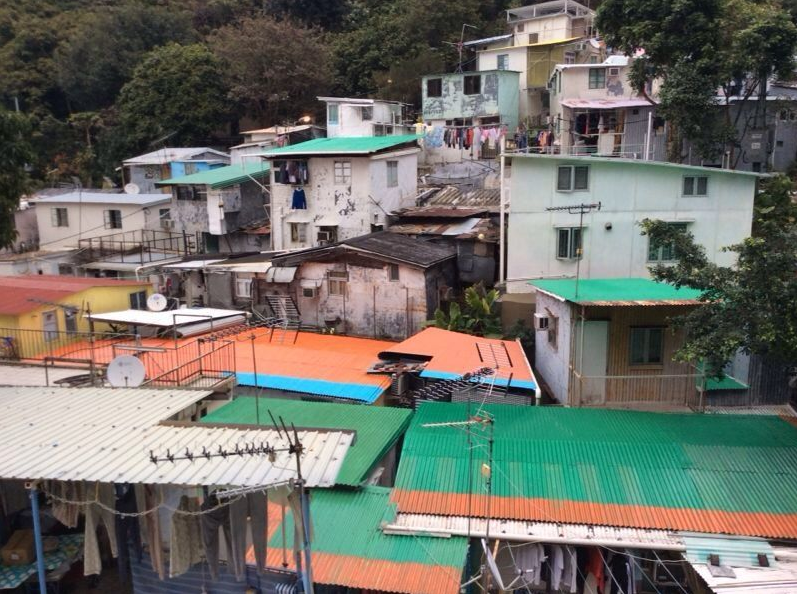
    Pokfulam Village is one of the oldest villages in Hong Kong, dating back to the 1730s. It has gone through several transformations: from a simple agricultural community; to a local commercial centre in the 1950s; to a densely populated low-rise community surrounded by high-rise housing projects. Despite these changes, local traditions are still central to village life. For example, during Mid-Autumn Festival, a locally crafted Fire Dragon is paraded around Aberdeen and Pokfulam Village to pray for good health and fortune. However, many people in Hong Kong do not know about the traditional culture of the village and wrongly believe it is an informal settlement.

    “According to the regulations of the 1982 squatter control policy enacted and enforced by the HK Government, many homes in Pokfulam Village are restricted in their use of material and the size of their structure so that no changes can be made to the physical materials of the structure even they deteriorate. The limited and low cost material palette of some of the village homes built in 1940s and 1980s, but whose materiality is fixed by the Policy, creates the illusion that Pokfulam Village is an urban slum”, said Mr. Allan Siu, core member of the Pokfulam Village Landscape Conservation.

    Interested in the complex environmental and cultural conditions present in the village, Cate Christ and Denizen sited their HKU design studio in the village, asking students to document and propose landscape interventions in the village. This engagement in the village led Cate Christ to apply for the ‘We Are With You Project’ (WAY Project) Fund with Mary Ho in order to fund the grassroots initiative to paint the roofs. Working with a group of HKU Landscape Architecture students and in consultation with the villagers, they mapped out which roofs could be painted, and designed a plan and colour palette based on site and visual research.

    “This weekend is only the beginning of the project. HKU students are only painting one quarter of the rooftops designated for painting by the design. We hope the initiative we have started will encourage other villagers to paint their rooftops and bring out the vibrancy of the village. Working closely with HKU faculty teachers and students in building a sustainable community, we hope to integrate urban heritage values into a wider framework of city development. This is also one of the recommendations in UNESCO’s Historic Urban Landscape, and we hope Pokfulam Village will be Hong Kong’s shining example”

    ‘Being a neighbour of Pokfulam Village, our University formed a partnership with Caritas Pokfulam Community Development Project to foster positive community capacity building in the village. Our students thus have the opportunity to discover the value of intentional communities, to develop habits of reflection and in reconciling people of different backgrounds and social groups, and also to demonstrate an understanding of sustainable community and heritage development in Hong Kong”, said Mary Ho of the HKU Gallant Ho Experiential Learning Centre.

    The WAY Project is a four-year community-based social capital development project in the Southern District. Its objective is to develop a replicable model for social capital development, particularly with the involvement of staff and students of HKU.

    The HKU student organization Residental Colleges Taking Action for NGOs (RC TANGO) made a video of the roof painting weekend which has several interviews and gives a nice perspective on the density and community spirit within the village.

    December 30-31, 2013
    Grassroots Balloon Mapping of Pokfulam Village
    Project team: BALS3 student research assistants May Chan Ka Ying, Issac Chui Ho Wan, Natalie Law Wai Yan, Monique Wong Hui Yan, Olive Wong Lok Yan, and Tony Yuen Chun Yin.

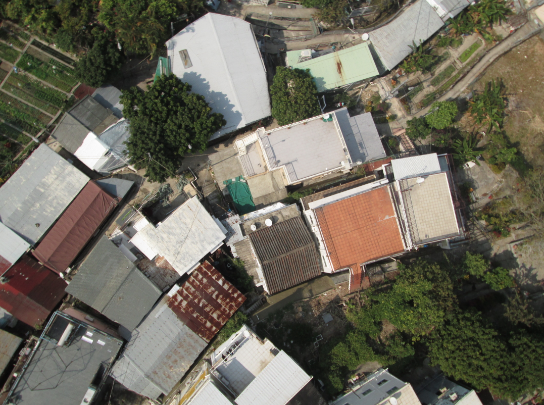
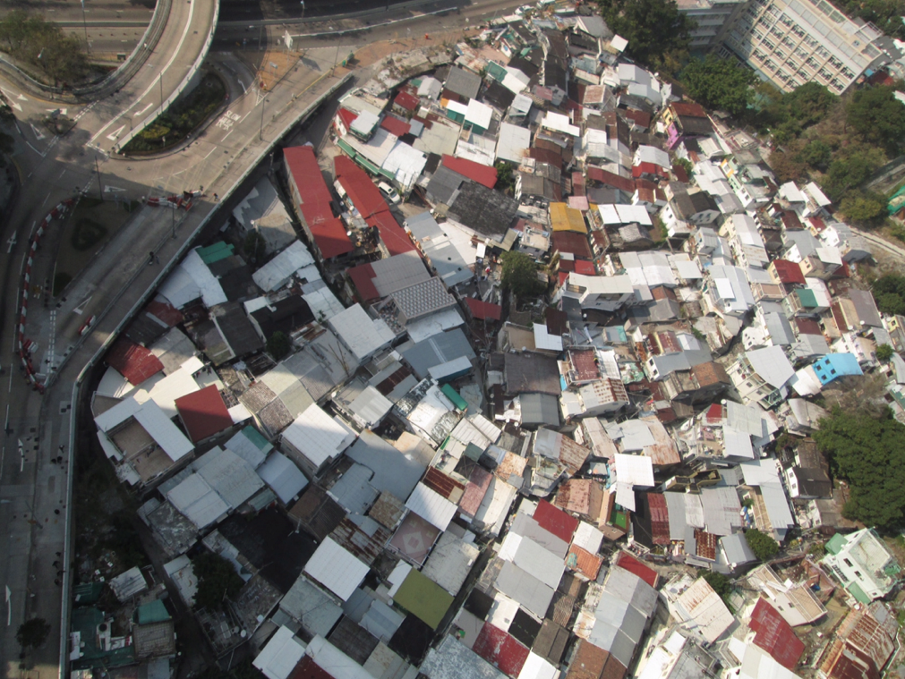
    As part of the site and research phase of the Pokfulam Village rooftop painting design project, BALS3 RAs spent two days creating a high resolution composite photograph of Pokfulam Village using grassroots mapping techniques – a 1.5m diameter weather balloon! Here are a few of the 10K shots they captured in 5 balloon launches from various parts of the village.
    roof painting in pokfulam villageroof painting in pokfulam village