Envisioning Pokfulam Village
Strategies of engagement and intervention in complex urban communities
BALS2 Fall 2013 ▪ ARCH 2043 Landscape Design Studio II: Site and Community
Instructors: Melissa Cate Christ and Seth Denizen
The collected work of the studio, including documentation of the workshop executed as part of ARCH2041 Environment Community and Design, can be found at pokfulamvillage.com
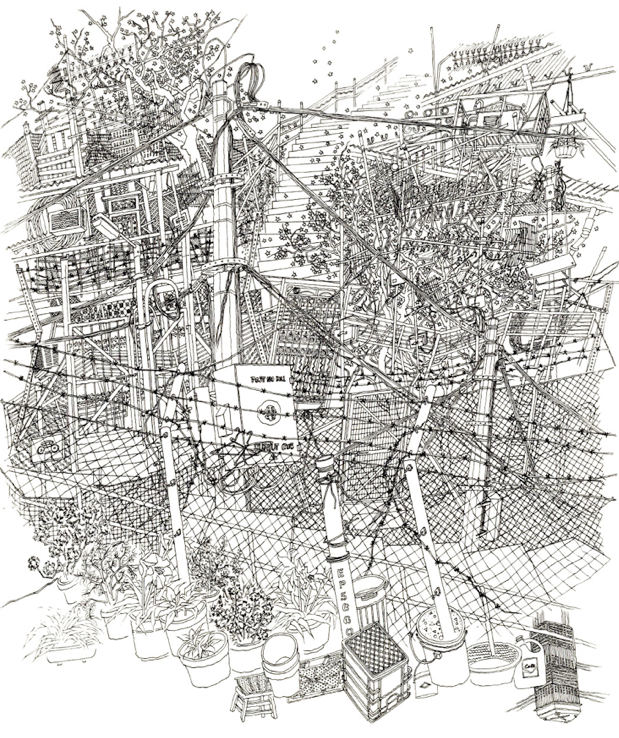
Sun Chang Lo, Pokfulam Village, Hong Kong, 1996
From the course syllabus & final project brief:
This studio looks at the relationship between site and community by asking how landscapes and lives are assembled. How can the relationship between people’s lives and the infrastructure of living be addressed by landscape architecture? Further, and perhaps most fundamentally, the studio asks how a landscape can shape the way we live.
Framed by these questions, the studio proposes to look at the assemblage of site and community relations in Pokfulam Village. In the original land allocation and layout of the village, each Hakka row house was allocated a plot of land to farm. As the population increased, many of the plots were leased and/or developed for non-formalized housing, leading a complex of different types of land tenure. In addition the 1982 Squatter Control Policy restricted the ability of residents to improve their homes, leading to the perception that the village is an urban slum due to its primary building material, metal sheeting, densely packed urban structure, and lack of basic sewage infrastructure. Ironically the Squatter Control Policy, combined with Pokfulam Road moratorium, has led to the preservation of the village, if only that it has not be redeveloped into high rise housing as much of the adjacent land has been. But with recent calls to lift the moratorium, community efforts to raise the profile of the village and to acknowledge its heritage value has led to it’s listing as a threatened site on the World Monuments Fund Watch list, raising the question of how to improve the living environment and accessibility of the village without losing its unque character and sense of community. In this context, the studio will explore the capacity and resilience of the village: what infrastructures, maintenance regimes and/or social practices can be embedded in the village and how would they be deployed and configured?
In order to answer this question, the studio is composed of a series of cumulative exercises. The first studio exercise asks students to uncover an essential element of the village through their own observations – documenting a phenomena, element, process or idea in the form of a photo diary and short text. The second exercise examines the village’s current food supply and demand through the production of measured orthographic drawings of the village’s markets. The third exercise of the studio asks students to produced detailed maps of the ground materials and systems of the village, integrating the first two exercises and laying the foundation for the final design project. The final exercise of the studio asks students to layout a strategy and site design which addresses an issue or problem identified in their system/network mapping.
Each exercise of the studio can be seen as a different way to explore the same fundamental questions: how landscapes and lives are assembled, how landscape shapes our lives, and how we shape the landscape. To that end, the studio exercises will be conducted in consultation with the local community through engagement exercises designed and executed by the students in the concurrent course, Environment Community and Design.
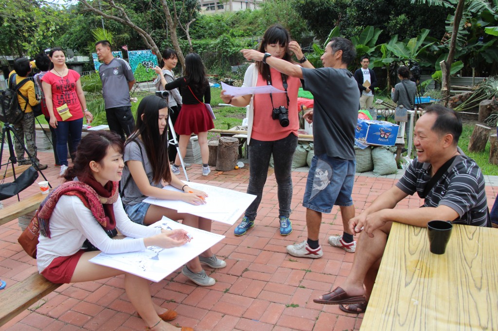
Envisioning Pokfulam Village workshop, November 10, 2013
How do we design in Pokfulam Village?
The first step to answering the question of how to act is to define our role. Pokfulam is a city of designers. Almost everything in Pokfulam is hand-made, down to the pipes and infrastructure that form the most essential core of the urban environment. This throws our role into question: should we replace them as designers of their city? Are we better or worse designers than they are? How can we design from the top-down in a place that is built bottom-up?
In order to formulate a coherent response to these questions we must think about the process of design as a partnership with the world, a process of becoming entangled in people’s problems and desires. In the community workshop, we will engage in the process of building this partnership in order to further entangle ourselves and our work with the problems and desires of Pokfulam. Another part of defining our role is to think strategically. For instance, the majority of the architectural problems in Pokfulam arise precisely at the moment when the scale of the problem exceeds the scale of a single home or single piece of property. In other words, problems do not get fixed when it’s not clear whose problem it is, or who is allowed to design a solution. Pokfulam is not the result of a single vision, but rather of hundreds of visions that have all been tightly and tragically constrained by legal frameworks.
Based on these considerations, our role then is to identify opportunities for interventions that address this scale – the problems that too large for the average resident to address by themselves. This will allow us to reimagine the parts of Pokfulam that no one has previously had the opportunity to address. For example, no one has had the opportunity to reimagine how to use the fragmented shards of space expropriated and fenced in by the government, but we can do this quite easily. No one has had the opportunity to consider the diverse kinds of public and semipublic space in Pokfulam as a single system, but this is also something we can do through our design proposals.
Our role is to provide solutions to Pokfulam’s problems that reimagine the future of the village – to provide alternatives to the impending destruction and displacement that is threatening the village and its residents.
 Below: Credit Oliver Turner