Category: HKU

  • Studio: Stair culture

    Stair Culture: Redefining Pedestrian Infrastructure
    Strategies of engagement and intervention in complex urban communities
    BALS2 Fall 2012 ▪ ARCH 2043 Landscape Design Studio II: Site and Community
    Instructor: Melissa Cate Christ & Maxime Decaudin

    From the course syllabus:
    There is a need to define a sense of place through buildings and other means, at the moment when such a sense of place (fragile to begin with) is being threatened with erasure by a more and more insistently globalizing space”.
    (Abbas, 1997, p.69)

    As part of the everyday landscape of mountainous Hong Kong, outdoor stairways play a critical role in creating a permeable and accessible public realm. Embedded in hillsides, stacked on sidewalks or replacing streets and alleys altogether, Hong Kong’s ubiquitous stairs are a reflection of the diverse character of the city itself, often exemplifying what Peter Rowe has called the “lane life” of the spaces in between buildings found in many East Asian cities (2005, p.121). Stairs act as an indicator of human contact, a marking of topography which becomes a cultural topographic map, evidence of a fundamental level of human-landscape intervention which is relatively sensitive to its surroundings. By enabling formalized pedestrian access to places previously inaccessible, stairs allow the occupation and transformation of slopes, making history in the places in which they are located.

    Historic or not, Hong Kong stairs are not recognized or protected as a class in Hong Kong. Only three out of thousands have been given any sort of heritage status, although many, at least in the Central and Western District, are made from local granite and date back to the mid-19th century, making them some of the oldest remaining built insertions in the city. As a result, evidenced by careless maintenance practices and significant infrastructural projects and proposals, the character, quality, and very fabric of the steps and their associated public realm is deteriorating or being eliminated. In addition, neighborhoods currently benefitting from the peaceful environment and relative vehicular inaccessibility that their topography provides, are under threat, in a city whose built heritage has only just begun to be publicly discussed and valued after half a century or more of physical and environmental degradation, neglect, and active destruction and replacement in the name of urban renewal and financial gain (Lee and DiStephano, 2007).

    Stair Culture
    Stairs are all too often seen as barriers to be replaced by an elevator or an escalator, rather than being understood as pieces of cultural and physical heritage which have shaped the very essence of the city. By investigating the role of stairs in defining the character of the Blake Garden neighborhood within the context of Hong Kong, a Stair Culture is discovered whose existence can condition types of intervention which will respect and improve the existing fabric of the city, rather than perpetuate the current practices of devaluation, destruction, and replacement of that which is deemed no longer useful or profitable enough. These destruct-to-construct practices have led to the generally poor condition of the public realm and the increasingly placeless, generic Hong Kong we find today.

    This studio project aims to redefine pedestrian infrastructure in Hong Kong as an agent in the creation of places of social and cultural value through strategies of situational redefinition where generic solutions are adapted to meet specific needs after a close examination and documentation of circumstances. As a typology of infrastructure, stairs are understood not just as circulation corridors but also as integral to the identity of the communities in which they reside – they both reflect and embody their environment.

    Cultural connections to stairs are not immediately apparent, but have meaning to the people who use them and places where they exist. These connections, and the sense of discovery and relative privacy they elicit, are valuable parts of a future city where difference can be prioritized over equality, community benefit over financial gain, slowness over speed, and meandering-through over travelling above.

    The studio consists of one project which is divided into five (5) parts: 1) photo diaries; 2) interpretive mapping & documentation; 3) case studies and precedents; 4) Area framework strategies; and 5) Site design interventions, which will be complemented by regular readings/ discussion on landscape topics and theory.

    Selected projects and the course syllabus are online here.
  • floating in Hong Kong

    March 29-30, 2014
    On Air: It all starts from the air
    Event organized by the Clean Air Network, art exhibition curated by Yan Kallen

    Melissa has been invited to exhibit photos from the ‘Floating in Hong Kong’ series at the event ‘On Air’ in Taipingshan. See the Facebook event page for more details.

    Artwork statement:
    Floating in Hong Kong
    Melissa Cate Christ / new.transversestudio.com/
    Project Team: Andrew Toland and 2012/13 HKU BALS2 students

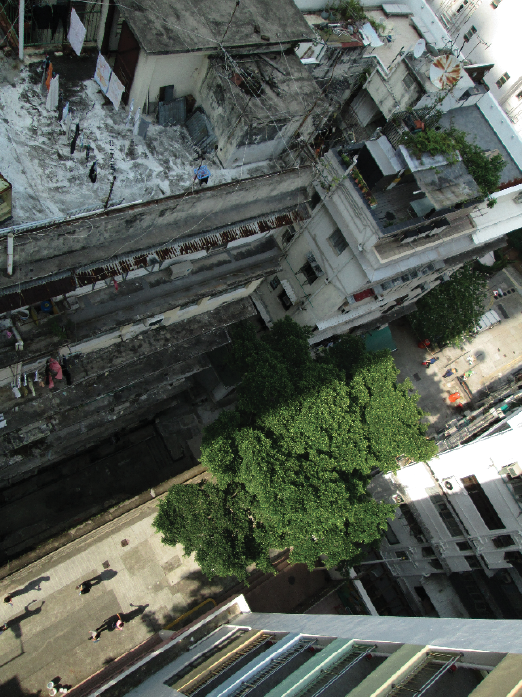
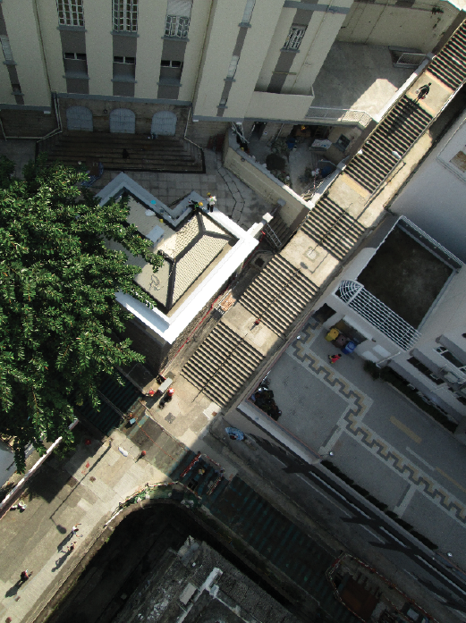
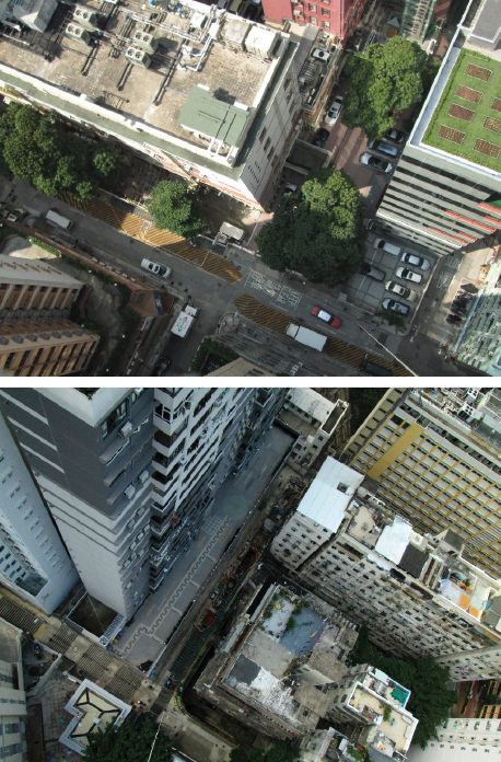
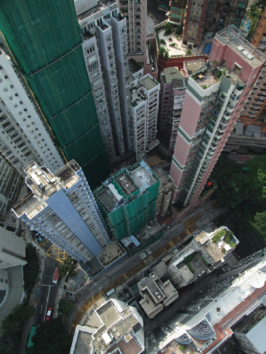
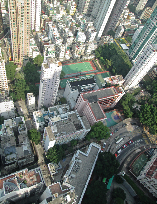
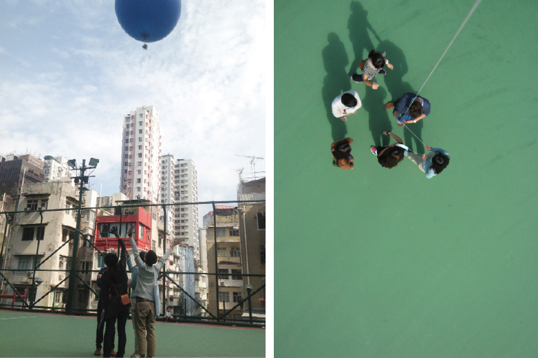
    This series presents a new way of seeing Taipingshan, familiar yet disorienting. Taken with a camera shooting continuously while attached to a weather balloon, the accidental and somewhat precarious perspectives flatten and convolute, but also reinforce, our typical understanding of Hong Kong’s densely layered urban environment. Simultaneously focusing on the neighborhood’s plentiful and often underused roofs and on the crevasses separating the towers, the images reveal the complex overlay of environmental, cultural and social conditions in Taipingshan. The lack of direct sunlight on a north-facing slope crammed tightly with high rise buildings, the visual and physical relief of trees and open spaces, people negotiating the city’s complex network of pedestrian pathways – the photos ask us to consider the duality of living both on the ground and in the air.
    Archiving a moment in a city perpetually reconstructing itself, our attention is captured by the spaces in between the buildings, the public spaces which are often overlooked by developers, but which make up our everyday lives, floating above, yet tethered to the ground.

    Excerpted from the organizers website:
    The Clean Air Network is hosting “ON AIR: It all starts from the air,” a two-day event which draws attention to air pollution, sustainable transport policies, and areas such as urban planning to explore how to make our cities more people-oriented. We invite the public to explore the neighborhood of Tai Ping Shan Street in Sheung Wan. In the public spaces, alleyways, parks, sport grounds and shops, there will be a variety of different happenings for the public to participate in. The hope is to rethink the relationship between air pollution, transportation policy, urban planning and our daily lives.

    Floating in Hong Kong
    Fall 2012 BALS2 Studio workshop
    Project Team: Andrew Toland and 2012/13 HKU BALS2 students

    Since moving to Hong Kong from Seattle two years ago to teach Landscape Architecture, I have often been frustrated when trying to use publically available aerial photos of this hyper-dense, hilly city in my practice and teaching. High-resolution aerials do exist, but are expensive to purchase. In those that I did acquire, much of the ground, stairs, alleys and streets in the study area of Sheung Wan on Hong Kong Island, is obscured or in shadow due to the height of the buildings and their location on a north-facing steep slope. Since aerials have always been a primary tool in my practice, it became increasingly apparent that I needed to find another way to document the present condition of the ground from the air. So after seeing a presentation by Liz Barry from the Public Laboratory for Open Technology & Science (PLOTS) about grassroots mapping, I decided to engage my students in a workshop to make our own low altitude aerials using a balloon and basic digital camera.

    floating in Hong Kong


    Imagining wrongly that the results of the workshop would allow us to stich together an accurate aerial picture of our studio site, the resulting photographs were surprisingly complex, uncovering a new way of working in and documenting Hong Kong. Piloted by the newly skilled hands of several BALS2 students, the photos document the strange juxtapositions between life on the ground and life up above, so familiar to many in this city of residential and commercial high rises. But their accidental angles, some bird’s eye views, some almost the view from a balcony or a roof terrace and some looking down precariously on even the taller buildings in the city, flatten and convolute but also reinforce our typical understanding of a densely layered urban environment. Simultaneously focusing on the buildings and on the spaces in between, the images captured by the rocking motion of the balloon question the typical modes of graphical projection we use in designing and representing our work and how they come to both define and limit our design proposals.
    What was intended as a basic aerial mapping exercise revealed instead a complex overlay of environmental conditions with cultural and social uses; the lack of direct sunlight on a north-facing slope crammed tightly with high rise buildings, the visual and physical relief of trees and open spaces, and people negotiating the city’s complex network of pedestrian pathways. Especially revealing was the coincidental overlay of multiple levels of living, integral to the lives of those who occupy the upper levels of buildings or are fortunate enough to have access to a terrace or roof. The perspectives captured by the balloon photos are almost familiar, but are disorienting enough to engender a reconsideration of the connections and spaces between the iconic and everyday buildings of Hong Kong, opening up a new way to guide future projects in this hyper-dense city.

  • studio yangon

    STUDIO YANGON
    MLA1 Spring 2014: Arch7102 Systems, Scales and Strategies in the Urban Landscape
    Instructors: Ivan Valin, Melissa Cate Christ and Scott Jennings Melbourne

    For more information, student blog and coursework, please see studioyangon.com

    studio yangon
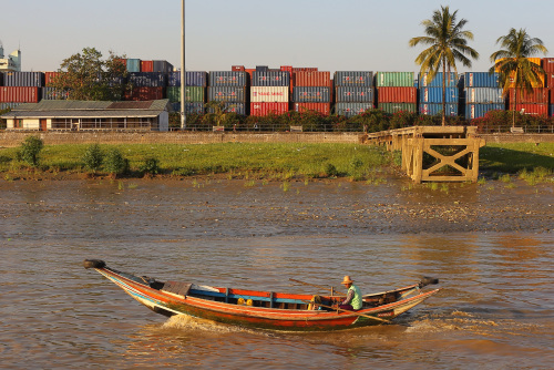
    This core studio of the MLA program explores the fundamental strategies of designing and planning in urban environments and takes on the unique challenges of cities undergoing rapid urban and ecological transformations within Southeast Asia. Studio Yangon 2014 is the first studio in a multi-year commitment by the division of Landscape Architecture to explore environmental design in Myanmar’s primate city. Our focus this year is on
    the Yangon River waterfront. This landscape, also known as the Strand, is a working port and logistics zone with heritage value and development potential—it is a contested site and one that deserves immediate attention. Ultimately the work done by the studio at the scale of the waterfront functions as a lens to understand the environmental, social, and infrastructural challenges impacting the city and region.

    The field trip to Yangon, from the 10th to the 17th of March, will engage students in an intense exercise to gain first-hand experience in arriving and gaining orientation within unfamiliar urban and cultural contexts. Skills in fieldwork will edify theoretical and disciplinary concepts related to landscape systems, environmental planning, and urban design introduced throughout the course. During the trip, students will be introduced to individuals who are actively engaged in planning and advocating for the future city. They will meet local professionals and students to exchange experiences and knowledge. The trip follows a concentrated period of preliminary site research across a range of subjects and will be followed by an 8-week site-design exercise in which the students will synthesize their observations and analysis into visions for a new waterfront and a new Yangon.

  • Hong Kong Detail Catalogue

    Hong Kong Detail Catalogue
    MLA1 Spring 2012 ▪ ARCH 7105 Landscape Technology 2

    OVERVIEW
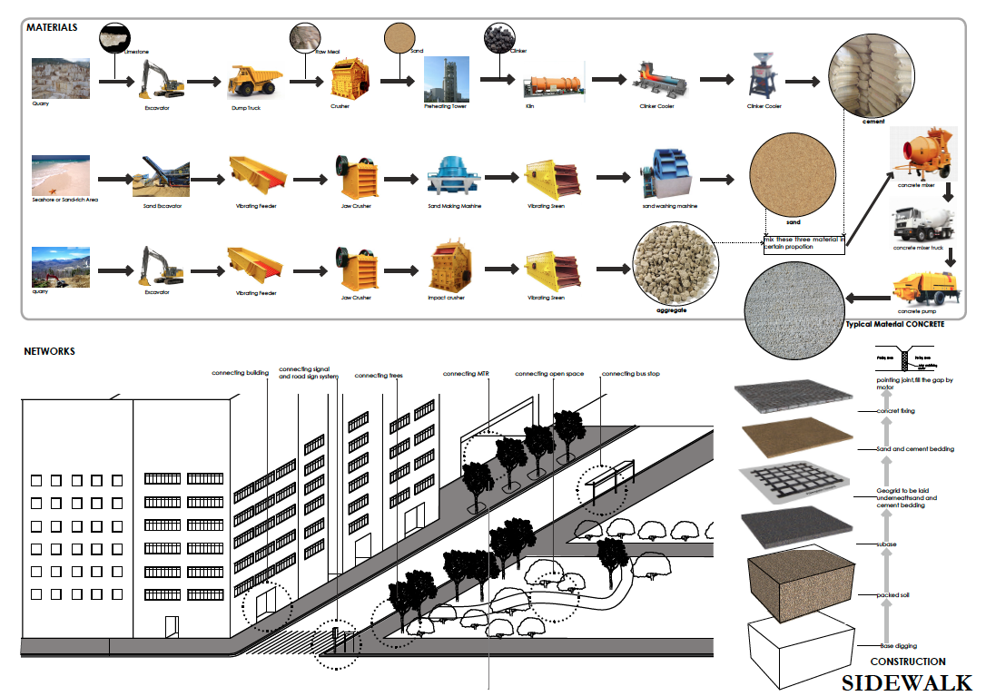
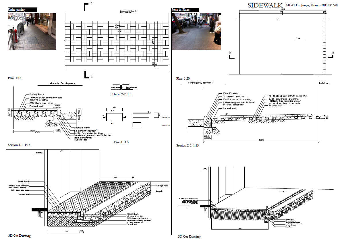
    As the second of two core landscape technology courses offered within the MLA curriculum, Landscape Technology 2 further investigates issues of site engineering, technology and construction, looking at typical and innovative landscape construction materials, methods and applications in the context of the urban environment. The course situates the built landscape, its cultural and environmental determinants and the resulting impacts of material extraction, sourcing, fabrication, installation, maintenance and disposal in relationship to the design and detailing of the urban landscape. The course readings and lectures are complemented by a multi-part research project which initially maps, catalogues, researches, and documents Hong Kong’s everyday public infrastructural details and assemblies.

    Term Project: HONG KONG DETAIL CATALOGUE
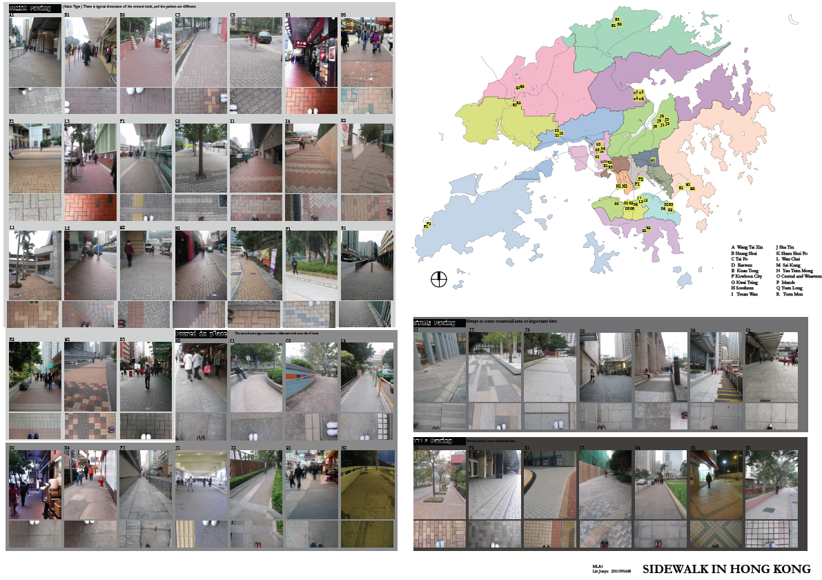
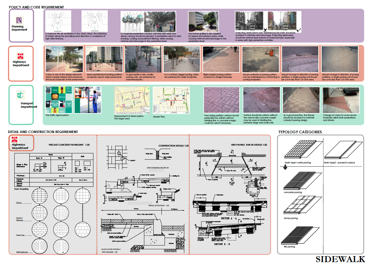
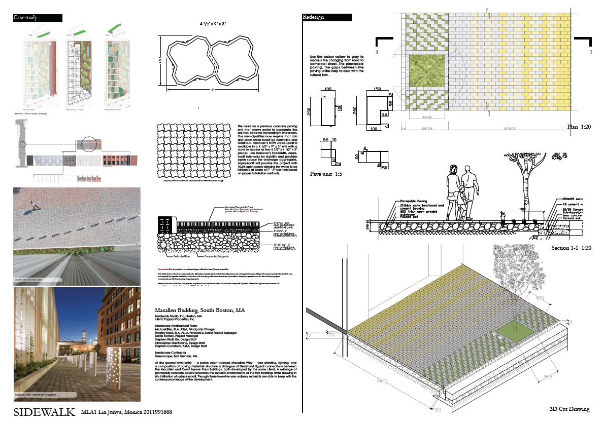
    With some of the densest urban areas in the world, Hong Kong has relied on the application of advanced landscape and infrastructure technology (eg land reclamation, detailed and exhaustive geological surveys, extensive public transportation investment) to further its geographical, topographical, and financial expansion. However, in the midst of billions of dollars spent on large scale infrastructural projects, many of the city’s public spaces are detailed, built, and maintained to a seemingly minimal standard. In this multi-part project, we will map, catalogue, research, and draw Hong Kong’s everyday public infrastructural details and assemblies. After the investigation of relevant case studies, each student will design and document a new detail assembly which improves both the functionality and aesthetic quality of a standard detail insertion and by extension, the entire network of infrastructural insertions. The project will be divided into four parts: 1) Typological documentation and mapping; 2) Detail construction research and drafting; 3) Case Studies/precedent research; 4) Design adaption and composite drawing. The four parts of the project will be compiled into a booklet to be submitted at the end of the term.

    The research and documentation from all of the students from the first part of the project is compiled on this open access Google Map.

    Please also see my article ‘Evidence of action: Towards an ecology of objects’, which places the student projects into a larger pedagogical framework.

    Typologies studied include:
    Curbs / Retaining walls/ Cut Slope stabilization / Fill Slope Stabilization / Handrails / Guardrails / Sidewalks / Benches /
    Stairs (at grade) / Drains / Water features / Tree pit/at grade planter / Planter (above grade) / Rubbish bin / Light standard (pole lighting) / In-grade/in-wall lighting / Bollards / Bike paths / Bus stops / Tram Stops / Ramp (intersection) / Crosswalk & pedestrian overpass / Pergola/trellis/canopy / Bike rack / Road signs

    The project below exemplifies the methodology and products of the term project (all image credits to Monica Lin)
    PART 1: Typological Documentation & Mapping( learning to see); PART 2: Typology Detail Construction Research (learning to research & represent) PART 3: Case Study/precedent & PART 4: Design adaption and composite drawing


  • roof painting in pokfulam village

    January 25 & 26, 2014
    Roof Painting in Pokfulam Village
    Designed by Melissa Cate Christ & Seth Denizen in collaboration with BALS3 students, and coordinated and supported by the Pokfulam Village Cultural Landscape Conservation Group, the Gallant Ho Experiential Learning Centre and the WAY Fund.


    From the project’s Press Release:
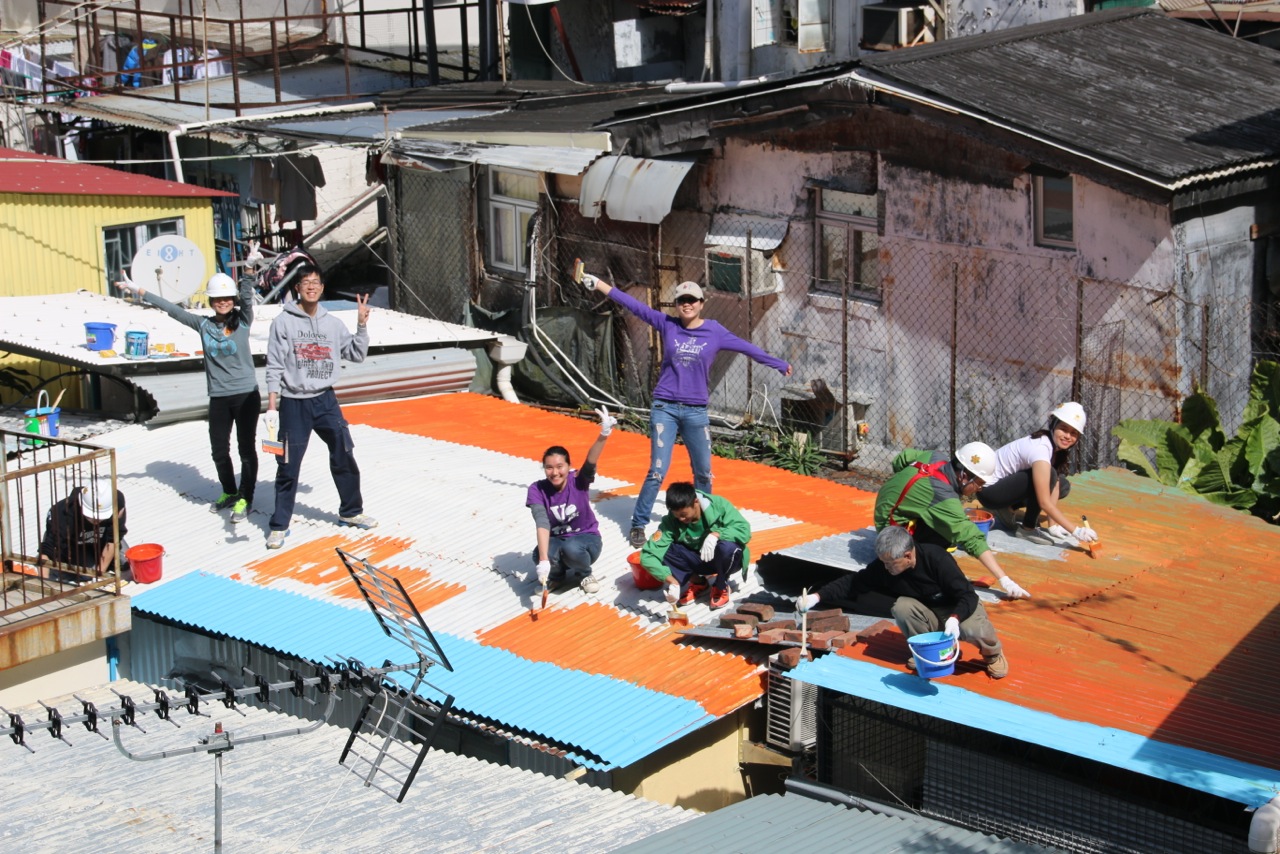
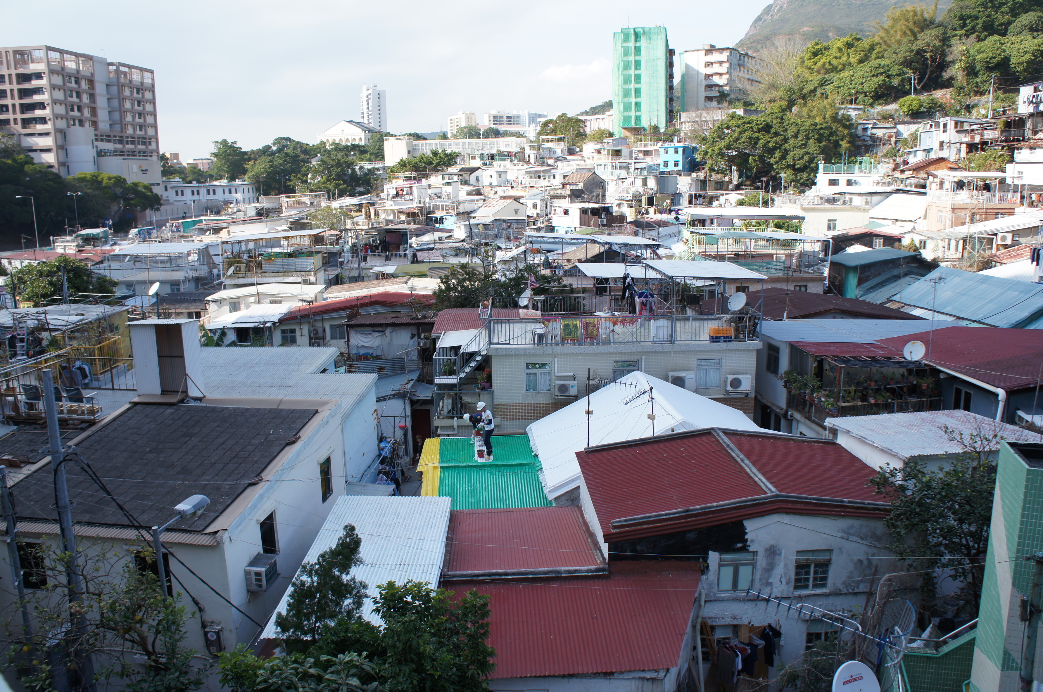
    On the weekend of January 25th and 26th, 174 students from the University of Hong Kong (HKU) painted 50 rooftops in Pokfulam Village. Designed by HKU Landscape Architecture professors Melissa Cate Christ and Seth Denizen based on site and visual research gathered by their team of Bachelor of Landscape Architecture student research assistants and in collaboration with villagers, the project aimed to support the Pokfulam Village Landscape Conservation Group and the Caritas Pokfulam Community Development Project’s efforts to co-build a sustainable community and advocate for the re-evaluation of the existing Squatter Control Policy.

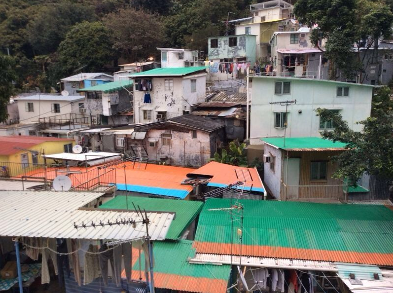
    Pokfulam Village is one of the oldest villages in Hong Kong, dating back to the 1730s. It has gone through several transformations: from a simple agricultural community; to a local commercial centre in the 1950s; to a densely populated low-rise community surrounded by high-rise housing projects. Despite these changes, local traditions are still central to village life. For example, during Mid-Autumn Festival, a locally crafted Fire Dragon is paraded around Aberdeen and Pokfulam Village to pray for good health and fortune. However, many people in Hong Kong do not know about the traditional culture of the village and wrongly believe it is an informal settlement.

    “According to the regulations of the 1982 squatter control policy enacted and enforced by the HK Government, many homes in Pokfulam Village are restricted in their use of material and the size of their structure so that no changes can be made to the physical materials of the structure even they deteriorate. The limited and low cost material palette of some of the village homes built in 1940s and 1980s, but whose materiality is fixed by the Policy, creates the illusion that Pokfulam Village is an urban slum”, said Mr. Allan Siu, core member of the Pokfulam Village Landscape Conservation.

    Interested in the complex environmental and cultural conditions present in the village, Cate Christ and Denizen sited their HKU design studio in the village, asking students to document and propose landscape interventions in the village. This engagement in the village led Cate Christ to apply for the ‘We Are With You Project’ (WAY Project) Fund with Mary Ho in order to fund the grassroots initiative to paint the roofs. Working with a group of HKU Landscape Architecture students and in consultation with the villagers, they mapped out which roofs could be painted, and designed a plan and colour palette based on site and visual research.

    “This weekend is only the beginning of the project. HKU students are only painting one quarter of the rooftops designated for painting by the design. We hope the initiative we have started will encourage other villagers to paint their rooftops and bring out the vibrancy of the village. Working closely with HKU faculty teachers and students in building a sustainable community, we hope to integrate urban heritage values into a wider framework of city development. This is also one of the recommendations in UNESCO’s Historic Urban Landscape, and we hope Pokfulam Village will be Hong Kong’s shining example”

    ‘Being a neighbour of Pokfulam Village, our University formed a partnership with Caritas Pokfulam Community Development Project to foster positive community capacity building in the village. Our students thus have the opportunity to discover the value of intentional communities, to develop habits of reflection and in reconciling people of different backgrounds and social groups, and also to demonstrate an understanding of sustainable community and heritage development in Hong Kong”, said Mary Ho of the HKU Gallant Ho Experiential Learning Centre.

    The WAY Project is a four-year community-based social capital development project in the Southern District. Its objective is to develop a replicable model for social capital development, particularly with the involvement of staff and students of HKU.

    The HKU student organization Residental Colleges Taking Action for NGOs (RC TANGO) made a video of the roof painting weekend which has several interviews and gives a nice perspective on the density and community spirit within the village.

    December 30-31, 2013
    Grassroots Balloon Mapping of Pokfulam Village
    Project team: BALS3 student research assistants May Chan Ka Ying, Issac Chui Ho Wan, Natalie Law Wai Yan, Monique Wong Hui Yan, Olive Wong Lok Yan, and Tony Yuen Chun Yin.

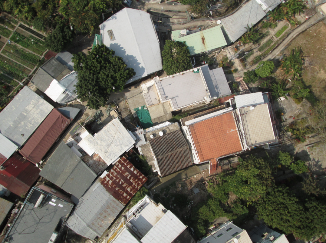
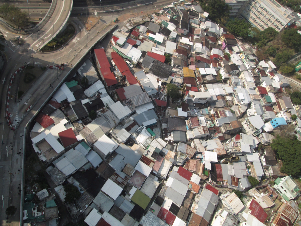
    As part of the site and research phase of the Pokfulam Village rooftop painting design project, BALS3 RAs spent two days creating a high resolution composite photograph of Pokfulam Village using grassroots mapping techniques – a 1.5m diameter weather balloon! Here are a few of the 10K shots they captured in 5 balloon launches from various parts of the village.
    roof painting in pokfulam villageroof painting in pokfulam village