March 29-30, 2014
On Air: It all starts from the air
Event organized by the Clean Air Network, art exhibition curated by Yan Kallen
Melissa has been invited to exhibit photos from the ‘Floating in Hong Kong’ series at the event ‘On Air’ in Taipingshan. See the Facebook event page for more details.
Artwork statement:
Floating in Hong Kong
Melissa Cate Christ / new.transversestudio.com/
Project Team: Andrew Toland and 2012/13 HKU BALS2 students
This series presents a new way of seeing Taipingshan, familiar yet disorienting. Taken with a camera shooting continuously while attached to a weather balloon, the accidental and somewhat precarious perspectives flatten and convolute, but also reinforce, our typical understanding of Hong Kong’s densely layered urban environment. Simultaneously focusing on the neighborhood’s plentiful and often underused roofs and on the crevasses separating the towers, the images reveal the complex overlay of environmental, cultural and social conditions in Taipingshan. The lack of direct sunlight on a north-facing slope crammed tightly with high rise buildings, the visual and physical relief of trees and open spaces, people negotiating the city’s complex network of pedestrian pathways – the photos ask us to consider the duality of living both on the ground and in the air.
Archiving a moment in a city perpetually reconstructing itself, our attention is captured by the spaces in between the buildings, the public spaces which are often overlooked by developers, but which make up our everyday lives, floating above, yet tethered to the ground.
Excerpted from the organizers website:
The Clean Air Network is hosting “ON AIR: It all starts from the air,” a two-day event which draws attention to air pollution, sustainable transport policies, and areas such as urban planning to explore how to make our cities more people-oriented. We invite the public to explore the neighborhood of Tai Ping Shan Street in Sheung Wan. In the public spaces, alleyways, parks, sport grounds and shops, there will be a variety of different happenings for the public to participate in. The hope is to rethink the relationship between air pollution, transportation policy, urban planning and our daily lives.
Floating in Hong Kong
Fall 2012 BALS2 Studio workshop
Project Team: Andrew Toland and 2012/13 HKU BALS2 students
Since moving to Hong Kong from Seattle two years ago to teach Landscape Architecture, I have often been frustrated when trying to use publically available aerial photos of this hyper-dense, hilly city in my practice and teaching. High-resolution aerials do exist, but are expensive to purchase. In those that I did acquire, much of the ground, stairs, alleys and streets in the study area of Sheung Wan on Hong Kong Island, is obscured or in shadow due to the height of the buildings and their location on a north-facing steep slope. Since aerials have always been a primary tool in my practice, it became increasingly apparent that I needed to find another way to document the present condition of the ground from the air. So after seeing a presentation by Liz Barry from the Public Laboratory for Open Technology & Science (PLOTS) about grassroots mapping, I decided to engage my students in a workshop to make our own low altitude aerials using a balloon and basic digital camera.
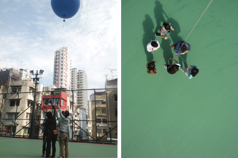
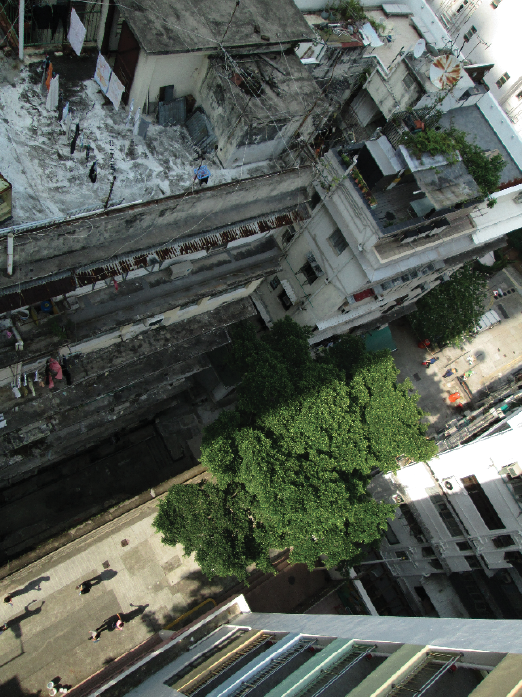
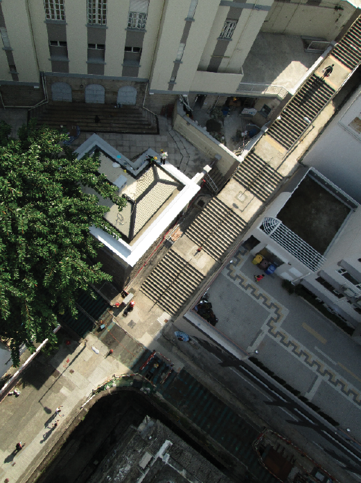
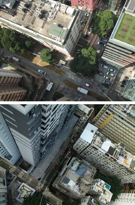
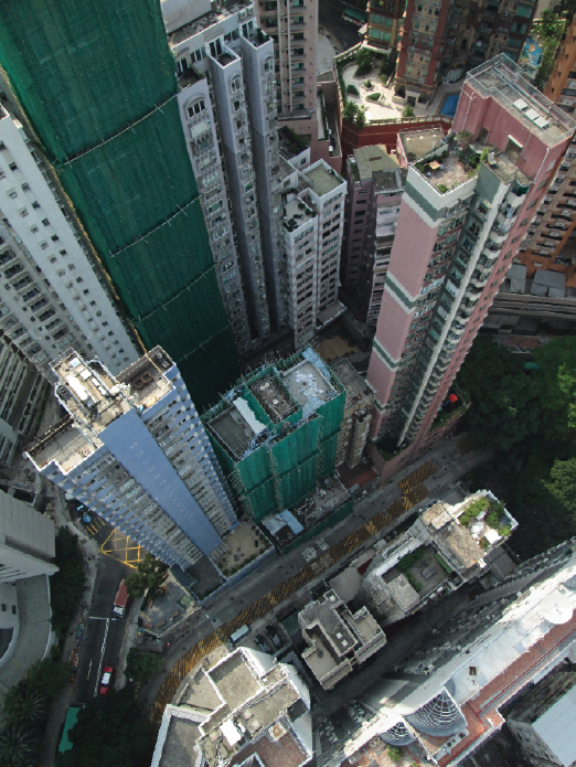
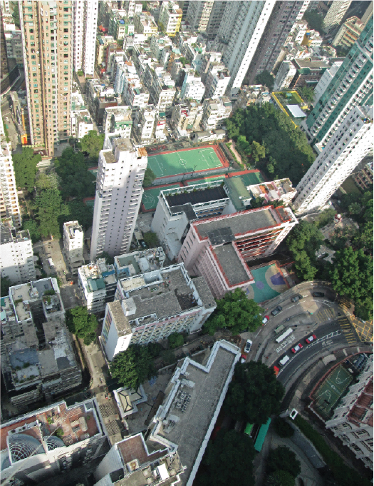
Imagining wrongly that the results of the workshop would allow us to stich together an accurate aerial picture of our studio site, the resulting photographs were surprisingly complex, uncovering a new way of working in and documenting Hong Kong. Piloted by the newly skilled hands of several BALS2 students, the photos document the strange juxtapositions between life on the ground and life up above, so familiar to many in this city of residential and commercial high rises. But their accidental angles, some bird’s eye views, some almost the view from a balcony or a roof terrace and some looking down precariously on even the taller buildings in the city, flatten and convolute but also reinforce our typical understanding of a densely layered urban environment. Simultaneously focusing on the buildings and on the spaces in between, the images captured by the rocking motion of the balloon question the typical modes of graphical projection we use in designing and representing our work and how they come to both define and limit our design proposals.
What was intended as a basic aerial mapping exercise revealed instead a complex overlay of environmental conditions with cultural and social uses; the lack of direct sunlight on a north-facing slope crammed tightly with high rise buildings, the visual and physical relief of trees and open spaces, and people negotiating the city’s complex network of pedestrian pathways. Especially revealing was the coincidental overlay of multiple levels of living, integral to the lives of those who occupy the upper levels of buildings or are fortunate enough to have access to a terrace or roof. The perspectives captured by the balloon photos are almost familiar, but are disorienting enough to engender a reconsideration of the connections and spaces between the iconic and everyday buildings of Hong Kong, opening up a new way to guide future projects in this hyper-dense city.