Blog

  • in the know

    February 2, 2013
    in the know: experiments in spatial memory

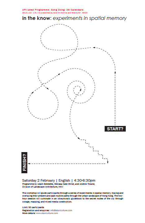
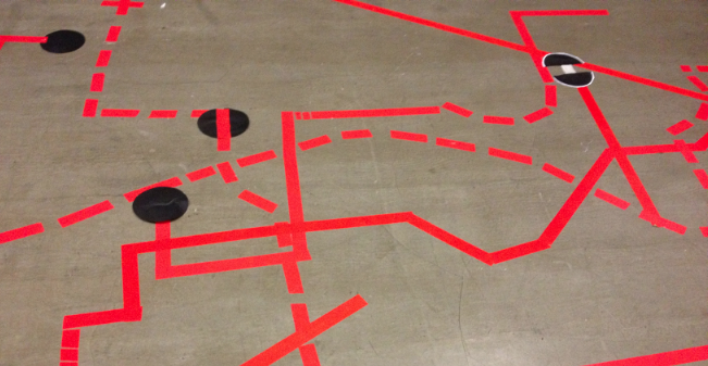
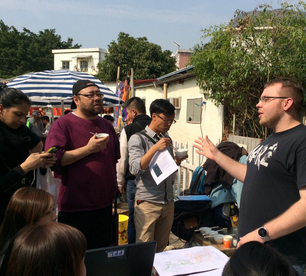
    At the invitation of the Asia Art Archive, Andrew Toland, Adam Bobbette and Melissa Cate Christ organized a workshop as part of Song Dong’s new exhibition, 36 Calandars, at ArtisTree, TaiKoo Place, HK. The workshop guided participants through a series of experiments in spatial memory, tracing and overlaying their present and past routine paths through the urban landscape of Hong Kong. The two hour session evidenced an idiosyncratic demonstration of the secret routes of the city through collage, mapping, and mixed media construction.

    More info on the Song Dong exhibition and other affiliated programmes here.
    A selection of photos from the workshop can be found here.
    in the know
    participant memory path intersections and overlays @ in the know, feb 2, 2013
    in the know

  • studio yangon

    STUDIO YANGON
    MLA1 Spring 2014: Arch7102 Systems, Scales and Strategies in the Urban Landscape
    Instructors: Ivan Valin, Melissa Cate Christ and Scott Jennings Melbourne

    For more information, student blog and coursework, please see studioyangon.com

    studio yangon
    This core studio of the MLA program explores the fundamental strategies of designing and planning in urban environments and takes on the unique challenges of cities undergoing rapid urban and ecological transformations within Southeast Asia. Studio Yangon 2014 is the first studio in a multi-year commitment by the division of Landscape Architecture to explore environmental design in Myanmar’s primate city. Our focus this year is on
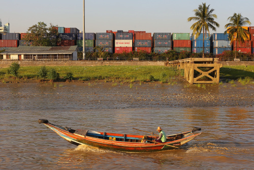
    the Yangon River waterfront. This landscape, also known as the Strand, is a working port and logistics zone with heritage value and development potential—it is a contested site and one that deserves immediate attention. Ultimately the work done by the studio at the scale of the waterfront functions as a lens to understand the environmental, social, and infrastructural challenges impacting the city and region.

    The field trip to Yangon, from the 10th to the 17th of March, will engage students in an intense exercise to gain first-hand experience in arriving and gaining orientation within unfamiliar urban and cultural contexts. Skills in fieldwork will edify theoretical and disciplinary concepts related to landscape systems, environmental planning, and urban design introduced throughout the course. During the trip, students will be introduced to individuals who are actively engaged in planning and advocating for the future city. They will meet local professionals and students to exchange experiences and knowledge. The trip follows a concentrated period of preliminary site research across a range of subjects and will be followed by an 8-week site-design exercise in which the students will synthesize their observations and analysis into visions for a new waterfront and a new Yangon.

  • alternate constructions

    alternate constructions: Stair culture in Hong Kong
    June 14-21, 2013
    11am-7pm daily
    Opening reception: June 14, 6-9pm
    Mapping workshop: June 15, 2-4pm
    TopZoo, 66 Po Hing Fong, Sheung Wan

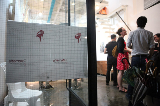
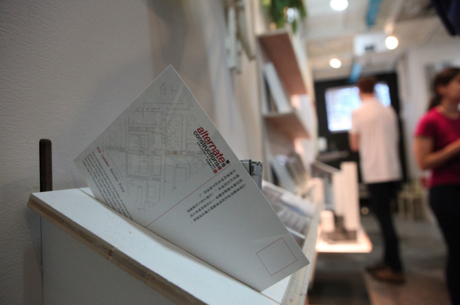
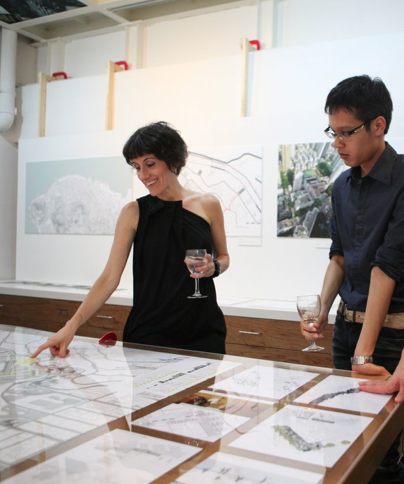
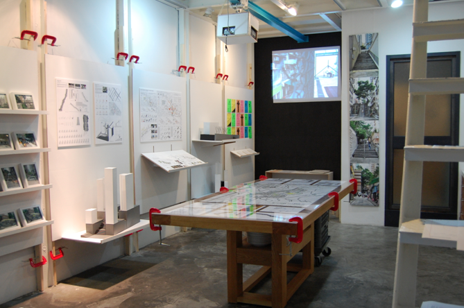
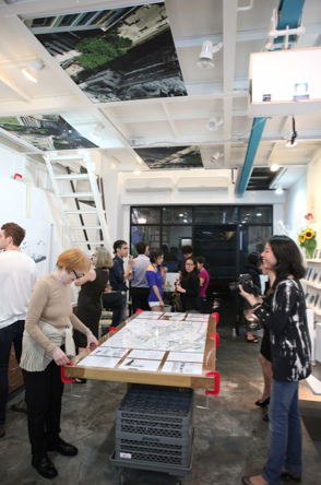
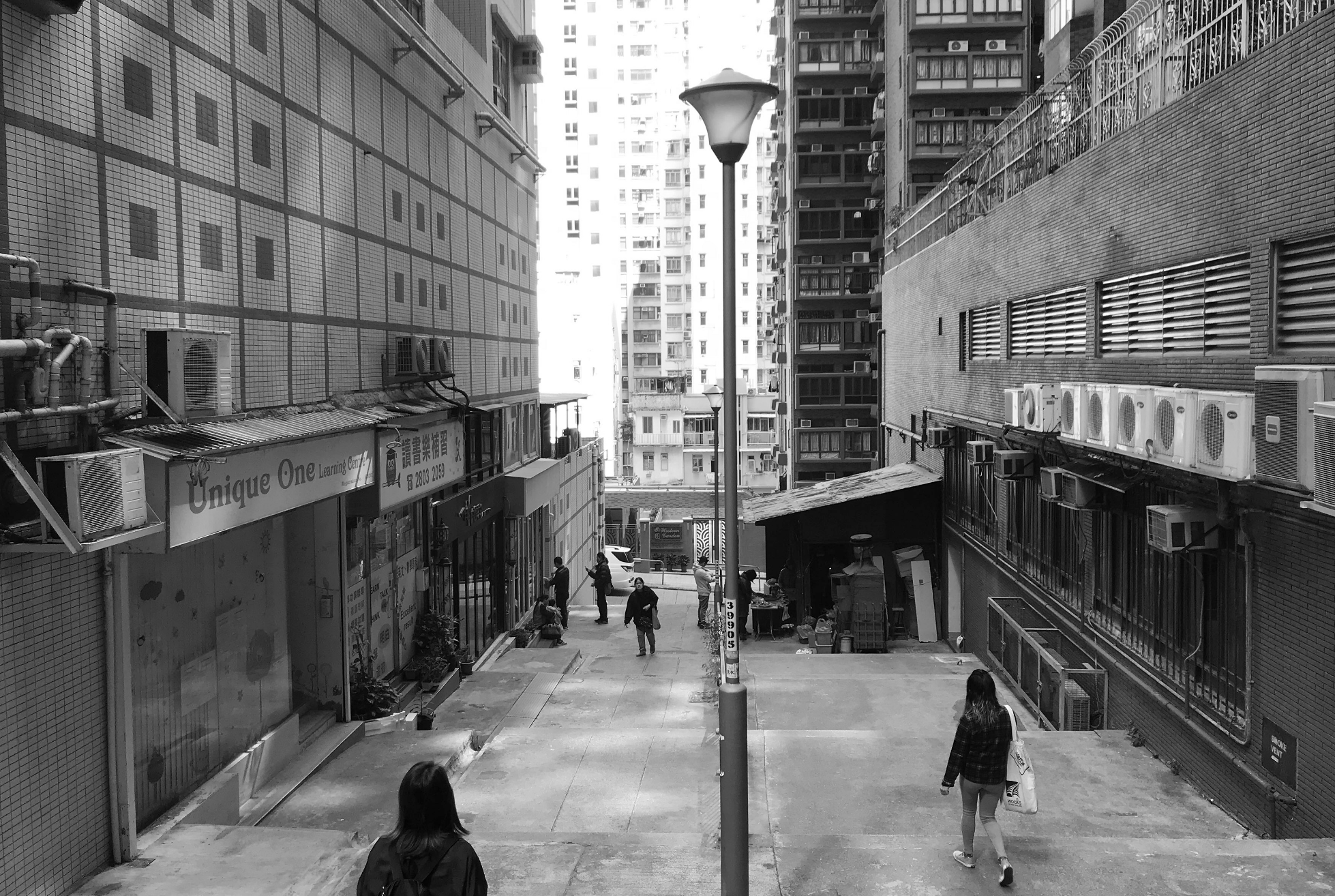
    The exhibition features the design research of HKU students and faculty in the context of the proposed escalator along Pound Lane.
    Organized by Melissa Cate Christ
    Exhibition design by Andrew Toland
    Supported by the Division of Landscape Architecture, University of Hong Kong and the Knowledge Exchange Fund.

    More info and images from the exhibition at an escalator for pound lane? and stairculture.com.
    Press statement and exhibition specs here.


  • view archive / archive view

    July 6, 2013
    viewing the archive / archiving the view
    Asia Art Archive Open Weekend

    Andrew Toland and Melissa Cate Christ were invited by the AAA to hold a workshop during Open Weekend which served as a participatory record of the AAA’s current space, employees and visitors. The workshop offered the public an opportunity to experience how designers document spatial conditions and experiences using the space of the AAA and its surroundings. Through a structured process, participants took on the roles of designer, artist, storyteller and archivist to create a visual narrative about the Archive and its immediate context in order to archive past, present and future stories in Sheung Wan.

    More info about Open Weekend and other events here.


  • floating in Hong Kong

    March 29-30, 2014
    On Air: It all starts from the air
    Event organized by the Clean Air Network, art exhibition curated by Yan Kallen

    Melissa has been invited to exhibit photos from the ‘Floating in Hong Kong’ series at the event ‘On Air’ in Taipingshan. See the Facebook event page for more details.

    Artwork statement:
    Floating in Hong Kong
    Melissa Cate Christ / new.transversestudio.com/
    Project Team: Andrew Toland and 2012/13 HKU BALS2 students

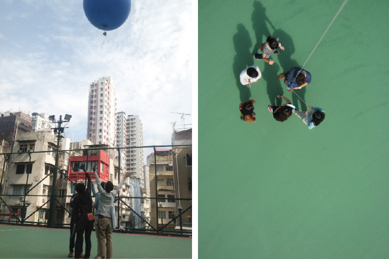
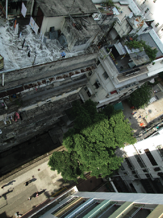
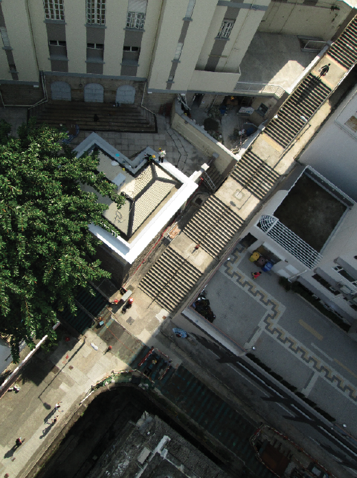
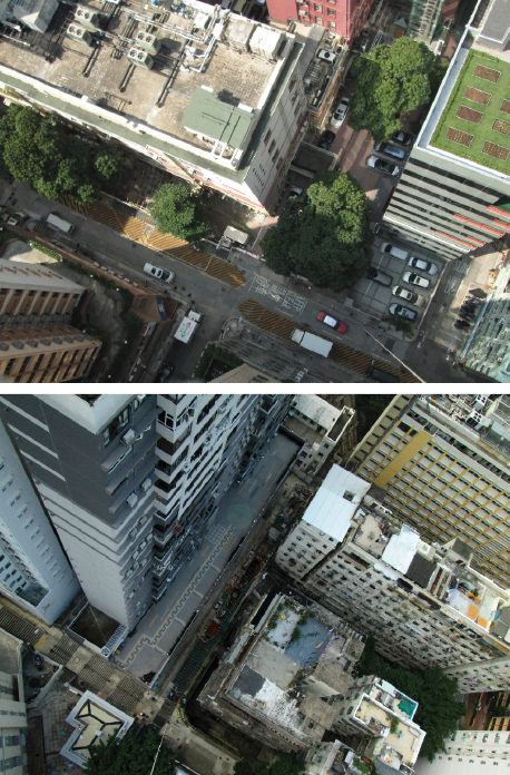
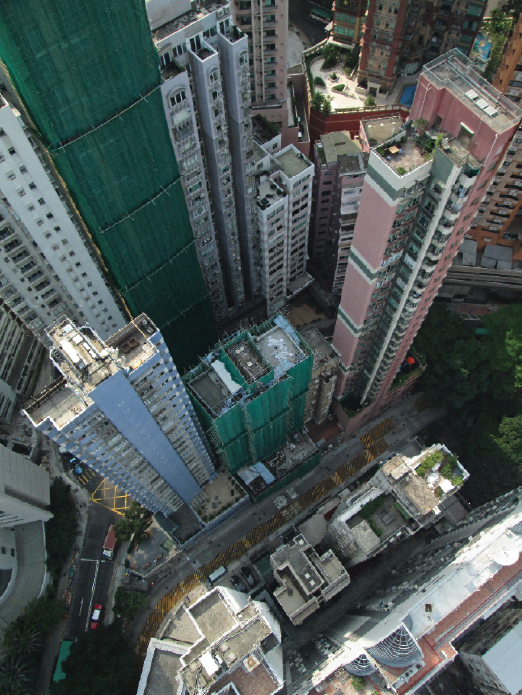
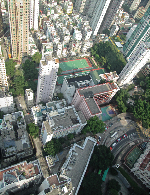
    This series presents a new way of seeing Taipingshan, familiar yet disorienting. Taken with a camera shooting continuously while attached to a weather balloon, the accidental and somewhat precarious perspectives flatten and convolute, but also reinforce, our typical understanding of Hong Kong’s densely layered urban environment. Simultaneously focusing on the neighborhood’s plentiful and often underused roofs and on the crevasses separating the towers, the images reveal the complex overlay of environmental, cultural and social conditions in Taipingshan. The lack of direct sunlight on a north-facing slope crammed tightly with high rise buildings, the visual and physical relief of trees and open spaces, people negotiating the city’s complex network of pedestrian pathways – the photos ask us to consider the duality of living both on the ground and in the air.
    Archiving a moment in a city perpetually reconstructing itself, our attention is captured by the spaces in between the buildings, the public spaces which are often overlooked by developers, but which make up our everyday lives, floating above, yet tethered to the ground.

    Excerpted from the organizers website:
    The Clean Air Network is hosting “ON AIR: It all starts from the air,” a two-day event which draws attention to air pollution, sustainable transport policies, and areas such as urban planning to explore how to make our cities more people-oriented. We invite the public to explore the neighborhood of Tai Ping Shan Street in Sheung Wan. In the public spaces, alleyways, parks, sport grounds and shops, there will be a variety of different happenings for the public to participate in. The hope is to rethink the relationship between air pollution, transportation policy, urban planning and our daily lives.

    Floating in Hong Kong
    Fall 2012 BALS2 Studio workshop
    Project Team: Andrew Toland and 2012/13 HKU BALS2 students

    Since moving to Hong Kong from Seattle two years ago to teach Landscape Architecture, I have often been frustrated when trying to use publically available aerial photos of this hyper-dense, hilly city in my practice and teaching. High-resolution aerials do exist, but are expensive to purchase. In those that I did acquire, much of the ground, stairs, alleys and streets in the study area of Sheung Wan on Hong Kong Island, is obscured or in shadow due to the height of the buildings and their location on a north-facing steep slope. Since aerials have always been a primary tool in my practice, it became increasingly apparent that I needed to find another way to document the present condition of the ground from the air. So after seeing a presentation by Liz Barry from the Public Laboratory for Open Technology & Science (PLOTS) about grassroots mapping, I decided to engage my students in a workshop to make our own low altitude aerials using a balloon and basic digital camera.

    floating in Hong Kong


    Imagining wrongly that the results of the workshop would allow us to stich together an accurate aerial picture of our studio site, the resulting photographs were surprisingly complex, uncovering a new way of working in and documenting Hong Kong. Piloted by the newly skilled hands of several BALS2 students, the photos document the strange juxtapositions between life on the ground and life up above, so familiar to many in this city of residential and commercial high rises. But their accidental angles, some bird’s eye views, some almost the view from a balcony or a roof terrace and some looking down precariously on even the taller buildings in the city, flatten and convolute but also reinforce our typical understanding of a densely layered urban environment. Simultaneously focusing on the buildings and on the spaces in between, the images captured by the rocking motion of the balloon question the typical modes of graphical projection we use in designing and representing our work and how they come to both define and limit our design proposals.
    What was intended as a basic aerial mapping exercise revealed instead a complex overlay of environmental conditions with cultural and social uses; the lack of direct sunlight on a north-facing slope crammed tightly with high rise buildings, the visual and physical relief of trees and open spaces, and people negotiating the city’s complex network of pedestrian pathways. Especially revealing was the coincidental overlay of multiple levels of living, integral to the lives of those who occupy the upper levels of buildings or are fortunate enough to have access to a terrace or roof. The perspectives captured by the balloon photos are almost familiar, but are disorienting enough to engender a reconsideration of the connections and spaces between the iconic and everyday buildings of Hong Kong, opening up a new way to guide future projects in this hyper-dense city.

  • planter making workshop

    Planter workshop with Rooftop Republic
    French International School, Hong Kong
    June 27, 2016

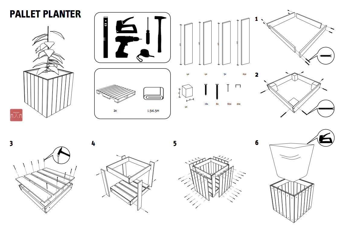
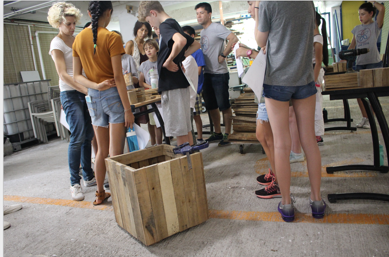
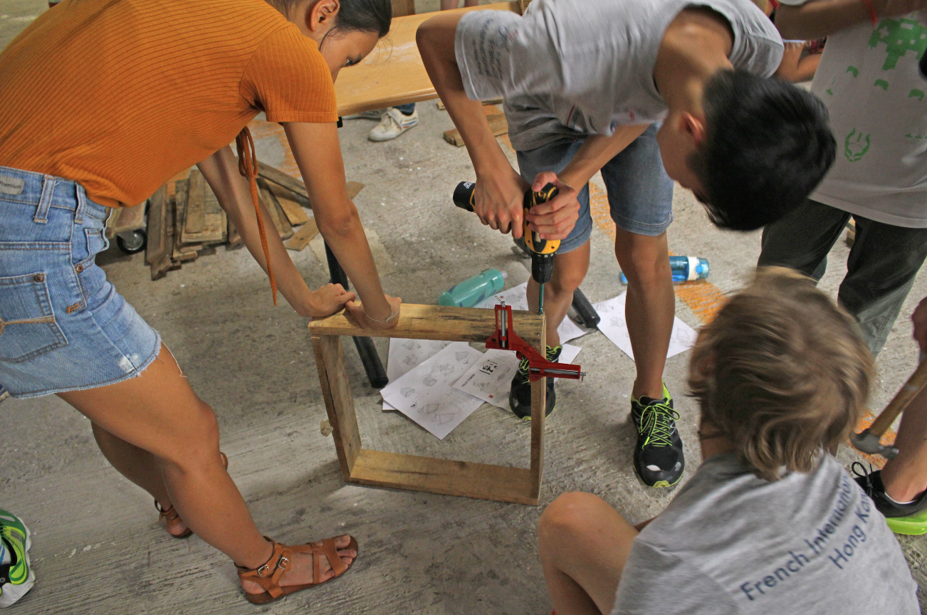
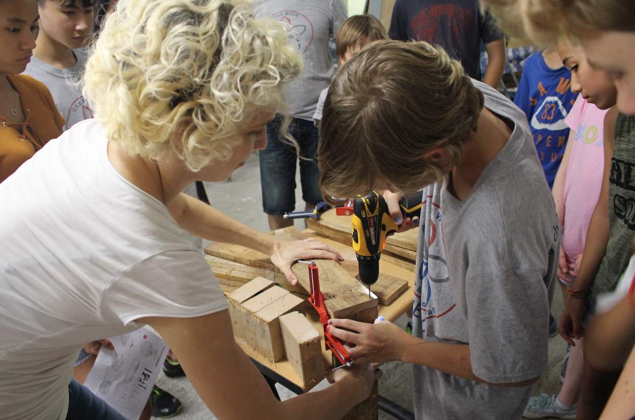
    At the invitation of Rooftop Republic as part of their educational programming, Melissa and Susanne Trumpf of in dialogue designed and organized a planter making workshop for secondary school students. Led by Susi, with preparatory work conducted at Maker Bay, the 3 hour workshop engaged students in making 50cm x 50cm x 50cm planters from reclaimed pallet wood, gaining valuable hands-on training in the use of power and hand tools, as well as in collaborative group work. The planters will be used at the school as part of their community garden.
    planter making workshopplanter making workshopplanter making workshopplanter making workshop Drawing credit: Susanne Trumpf. Photo credits: Rooftop Republic

  • Stair Quest workshop

    June 01, 2019
    Stair Quest workshop
    Magic Lanes, Shop 7 Yee Fung Court, Sheung Fung Lane, Sai Ying Pun, HK
    3-6pm

    Stair Quest workshop
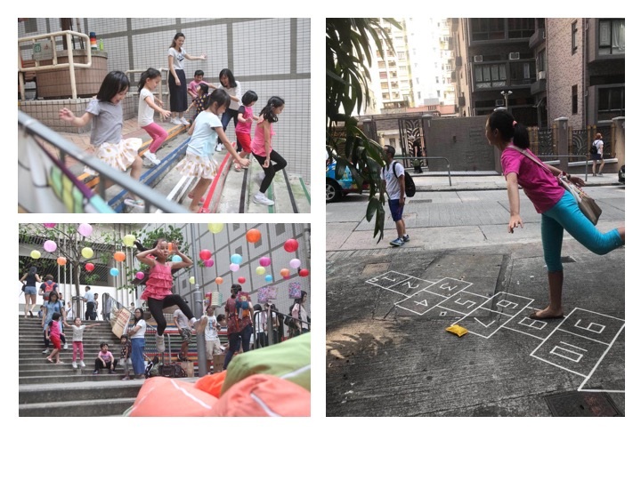
    The Hong Kong Stair Archive held its second round of the Stair Quest game workshop 01 June 2019, collaborating with photographer, architect Hans Leo Maes. Hans presented a tutorial of his tips and tricks for photographing stairs, and the group headed out in teams to play the game, gathering key info and photos of stairs in Sai Ying Pun. Thanks to all who attended!

    See the workshop info below and get in touch if you would like to join the Quest!

    What to bring | A fully charged smartphone

    Agenda | The workshop will consist of a short tutorial on taking photos of stairs with architect Hans Leo Maes and an introduction to the workings of the game, then we will set out to play!

    ******************************************************************************
    “A long, long time ago, there was an epic battle between mighty dragons. Hong Kong’s protective dragon fell and was shattered into more than 3000 pieces. The turned into stone and the dragon’s spirit has since been buried in the stairs of Hong Kong Island”

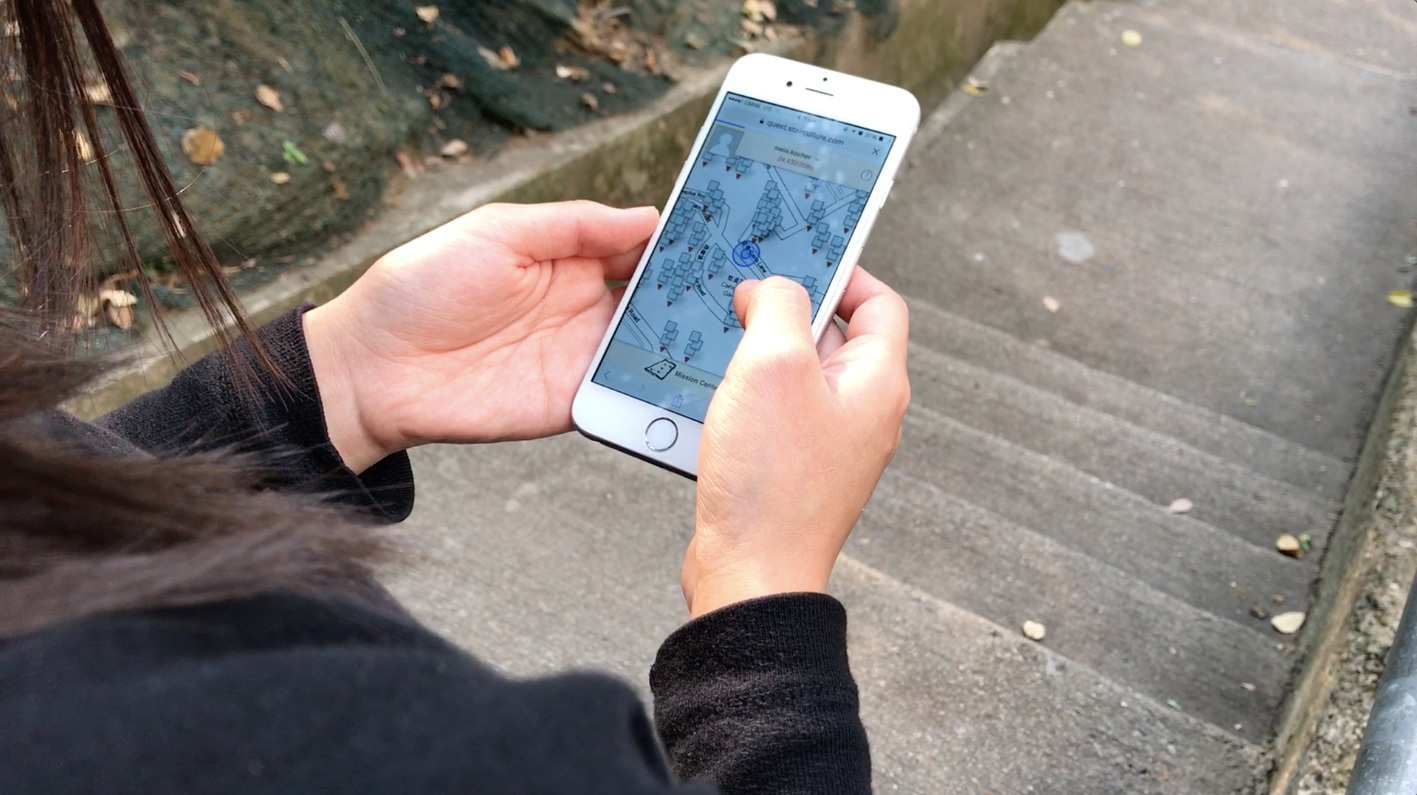
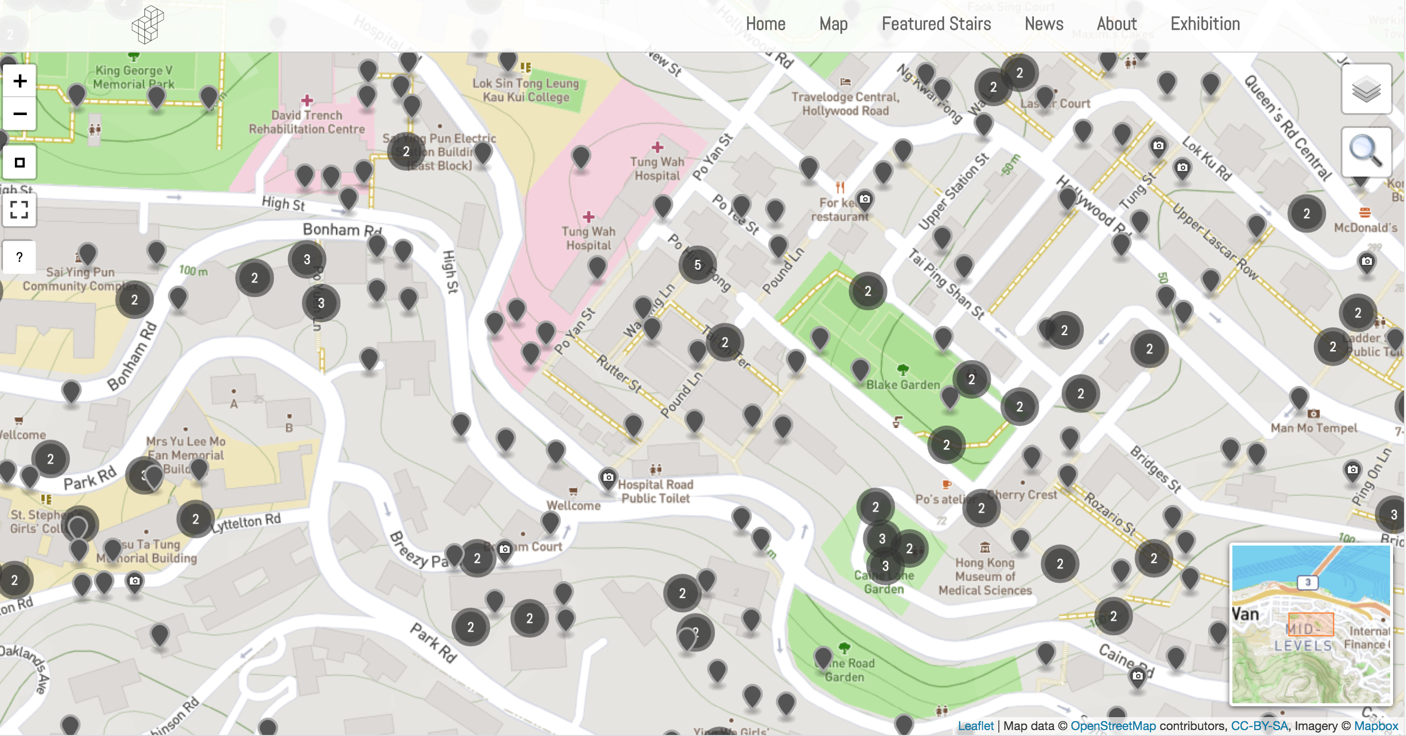
    Stair Quest is an urban game — a game that is played by walking around in the city with your smartphone. Stair Quest is also a serious game: you are helping the Hong Kong Stair Archive project by gathering data on stair culture. Together with Melissa, the lead for the project Hong Kong Stair Archive, you will play the mobile phone game, solve quests, and help free the Spirit Dragon! All ages are welcome.

    Stair Quest was designed by Stefan Schmidlin and Mela Kocher, and has been updated by Darcy Christ.

    What device do I need to play the game?
    You need a recent Android smartphone or an iPhone with a data plan to play. While playing, please make sure that your GPS location services are enabled. It is not possible to play Stair Quest with a computer.

    What is the privacy policy?
    While you are playing, your location will be tracked, but we do not store any location data on our server other than your stair check-ins. We do, however, use Google Analytics to improve the game experience and track its success. Also, we use Facebook as a login to protect us from spam users, but we do not read your profile information or send data back to Facebook.

    By playing this game, you are consenting to allow your anonymized player data (such as in-game content) be used for research related to stairs and Hong Kong’s Stair Culture.

    Check out the event post here.


  • book chapters

    August 26, 2022
    Hong Kong’s Urban Renewal Fund: A Step towards Citizen-driven Placemaking?
    Edited by Im Sik CHO, Blaž Križnik, and Jeffrey Hou
    Melissa Cate Christ and Hendrik Tieben

    We are excited to announce the publication of ‘Hong Kong’s Urban Renewal Fund: A Step towards Citizen-driven Placemaking?’, a chapter written by Melissa and Hendrik Tieben in the new book Emerging Civic Urbanisms in Asia: Hong Kong, Seoul, Singapore, and Taipei Beyond Developmental Urbanization, edited by Im Sik CHO, Blaž Križnik, and Jeffrey Hou. Please find the chapter here, the abstract below and more information about the book (and how to purchase it) here.
    book chapters
    Abstract
    This chapter investigates the relationship between Hong Kong’s Urban Renewal Fund (URF) and citizen-driven placemaking (CDP). The URF was launched in 2011, in response to growing public concern about projects undertaken by Hong Kong’s Urban Renewal Authority (URA). After discussing the evolving relationship of civil society to redevelopment and the background of the URF, the chapter presents three funded projects that utilize CDP approaches. The chapter examines the institutional frameworks and actors, and the achievements and limitations of CDP in the context of this state-sponsored programme. It also addresses prevailing contradictions between the small-scale, citizen-driven projects supported by the URF, and the large-scale redevelopment projects undertaken by the URA, as well as their implications for future civic urbanism in Hong Kong.
    Keywords: Hong Kong, Citizen-Driven Placemaking, Community Building, Public Space

    February 16, 2021
    Ambiguous Topologies of Public Open Space in Hong Kong: Stairs, Alleyways, Sitting-out Areas, Parks, Playgrounds, Privately Owned Public Spaces and Vacant Lots
    Interstitial Hong Kong: Exploring the Miniature Open Spaces of High-Density Urbanism (Jovis), p. 80-97
    Ed. by Susanne Trumpf, Xiaoxuan Lu and Ivan Valin
    Melissa Cate Christ and Andrew Toland
    book chapters
    We are pleased to announce that Ambiguous Topologies of Public Open Space in Hong Kong: Stairs, Alleyways, Sitting-out Areas, Parks, Playgrounds, Privately Owned Public Spaces and Vacant Lots, a chapter written by Melissa and Andrew Toland, has been published in the book Interstitial Hong Kong: Exploring the Miniature Open Spaces of High-Density Urbanism, edited by Susanne Trumpf, Xiaoxuan Lu and Ivan Valin. Please find an except from the chapter below and more information about the book (and how to purchase it) here.

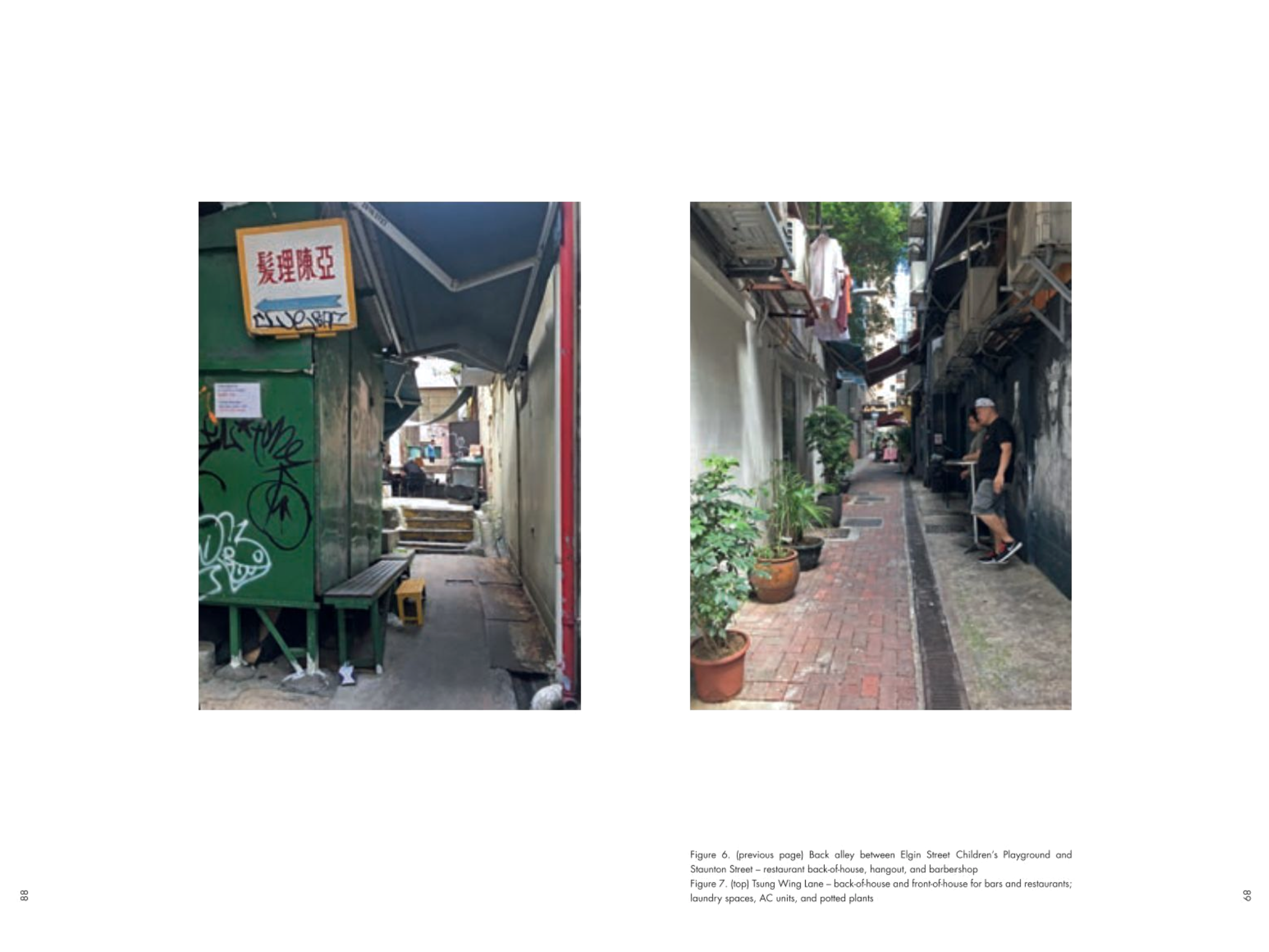
    In the densely-occupied, hilly urban areas of Hong Kong Island, public open space is limited and often fragmented. By necessity, these scarce spaces are multifunctional, resisting normative and typical categories of classification. Every in-between space that does exist is often a site of occupation, processes, flows, materials, wastes, and daily routines that are undertaken by both human and non-human actors. These spaces comprise a complex, mostly contiguous, network of streets, alleys, stairs, plazas, parks, Sitting-out Areas, Rest Gardens, Children’s Playgrounds, privately-owned public spaces and passageways, overhead walkways, underground tunnels, terraces, planter beds, drainage channels, and even vacant parcels of land. Of these spaces, only some are labeled and maintained by the government as public “open space”. This latter type of official space, categorized as Parks, Children’s Playgrounds, Sitting-out Areas, and Rest Gardens (the latter two being the focus of this publication), have signposted rules and sometimes full-time attendants and/or cameras to enforce what is allowed (or not) in these, often tiny, fragments of land. However, the practices in these spaces are not limited only to “allowed activities”, and the allowed activities are not limited only to these spaces. In fact, some practices are common to all of the parts of the more loosely defined open space network mentioned above, whereas others seem to be more unique and localized.

    It is often difficult to distinguish which type of space one is occupying through its formal classification alone. In such dense, over-built, and often vertiginous conditions, spaces have a tendency both to bleed into one another, but also to be interrupted and disjoined in unexpected and surprising ways. Fully comprehending the ways in which human and non-human actors use, maintain, and occupy this system, requires an understanding of the complex connections between the spaces and the actors within those spaces; and their participation in both the local and wider open space network. This chapter explores the topology of these actors and sites within the larger network of public open space, highlighting the ambiguity of their formal classification and focusing on the practices which connect or disconnect many of these sites.

    November 09, 2020
    Magic Lanes: A placemaking approach for alley spaces in Hong Kong
    Asian Alleyways: an Urban Vernacular in Times of Globalization (Amsterdam University Press), p. 181-205.
    Ed. by Marie Gibert-Flutre and Heide Imai
    Melissa Cate Christ and Hendrik Tieben
    book chapters
    We are pleased to announce that Magic Lanes: A placemaking approach for alley spaces in Hong Kong, a chapter written by Melissa and Hendrik Tieben, has been published in the edited volume Asian Alleyways: an Urban Vernacular in Times of Globalization, Ed. by Marie Gibert-Flutre and Heide Imai. Please find the abstract below and the full chapter here.

    With one of the highest population densities in the world, Hong Kong suffers from a lack of public open space. Despite this situation, open spaces provided by government authorities or private developers often do not meet residents’ needs or include residents in the planning and design process. To explore one way that this issue is being addressed, this chapter describes an ongoing placemaking project within Hong Kong’s interstitial network of laneways (里) and alleys (巷). The key historical, sociocultural, and physical features, opportunities, and constraints of these in-between spaces are discussed. This is followed by an in-depth exploration of the case study Magic Lanes, a pilot project that aims to provide more inclusive public open spaces through placemaking and community co-creation.

    November 02, 2019
    DigitalXPlace published
    Placemaking Fundamentals for the Built Environment (Palgrave Macmillian) Ed. Dominique HesCristina Hernandez-Santin.
    Andrew Toland, Melissa Cate Christ, Julian Worrall

    We are pleased to announce that DigitalXPlace, a chapter written by Andrew Toland, Melissa and Julian Worrall has been published in the edited volume, Placemaking Fundamentals for the Built Environment (Palgrave Macmillian) Ed. Dominique HesCristina Hernandez-Santin. Please find the abstract below and the full chapter is available here.

    book chapters
    Digital placemaking is a term given to a range of evolving practices that combine emerging digital technologies and placemaking initiatives. Over the past five years, its meaning has significantly shifted as a result of the proliferation of smartphones as mobile technological platforms and the ubiquity of social media. This chapter aims to move beyond the current fashionability of both the ‘digital’ and ‘placemaking’ discourses to provide a critical consideration of various ways in which technology is shaping social-spatial design, research, and practices and vice versa. It considers a number of diverse cases in which urban situations and digital technologies have intersected. Ultimately, however, we argue that the techno-social matrix through which we currently perceive and understand the city is now already deeply suffused with digital media and tools, raising a question as to what the adjectival modifier ‘digital’ actually illuminates. This requires us to refocus our attention back towards the making of places with the most effective tools available, which will inevitably involve a mix of the analogue and the digital.

    Keywords
    Digital placemaking; Crowdsourcing; Community mapping; Participatory design; Post-disaster; Temporary urbanism .

  • mapPokfulam

    May 3, 2015
    #MapPokfulam project featured on TVB’s Sunday Report
    (in Cantonese)

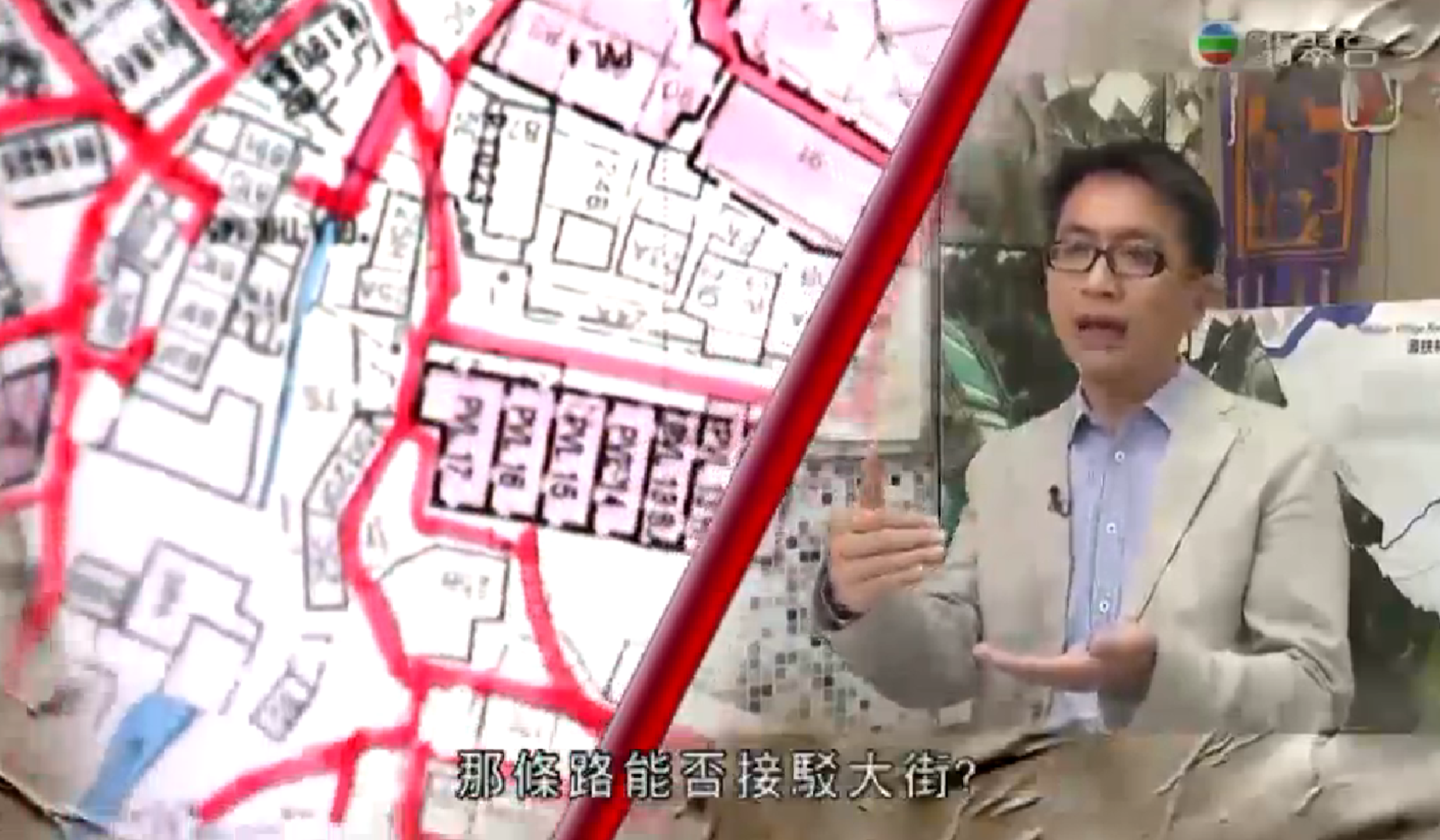
    Our MapPokfulam project has been featured on the most recent episode of the TVB program Sunday Report. The program focuses on three community / grassroots mapping projects in Hong Kong and includes an interview with Melissa and Benjamin Sin. See the program here. mapPokfulammapPokfulam
    This community mapping project is supported by the Hong Kong Southern District Council and the Southern District Health and Safety Association in collaboration with Caritas and the Pokfulam Village Cultural Landscape Conservation Group, Pokfulam Villagers and university students.

    March 8, 2015
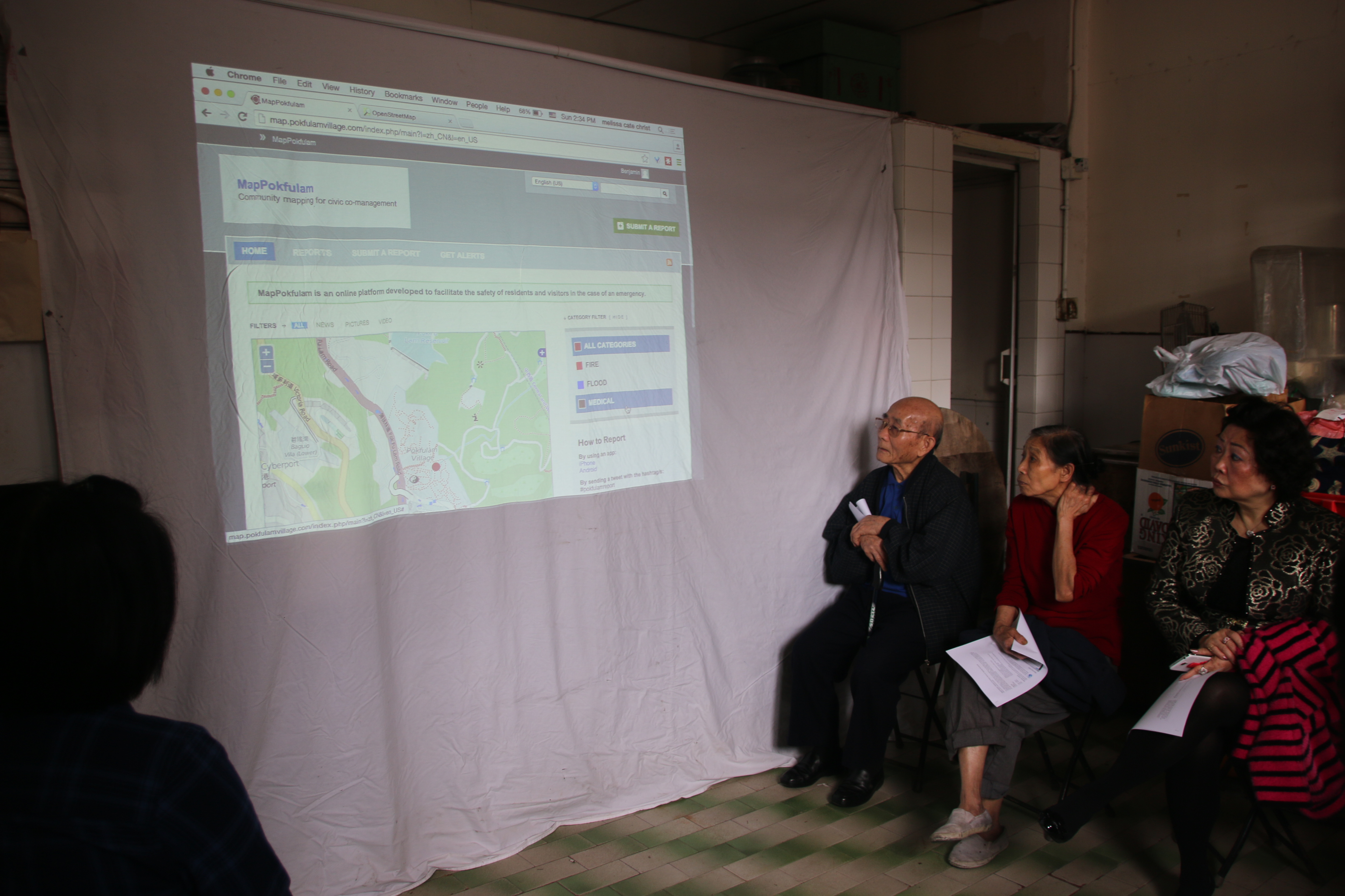
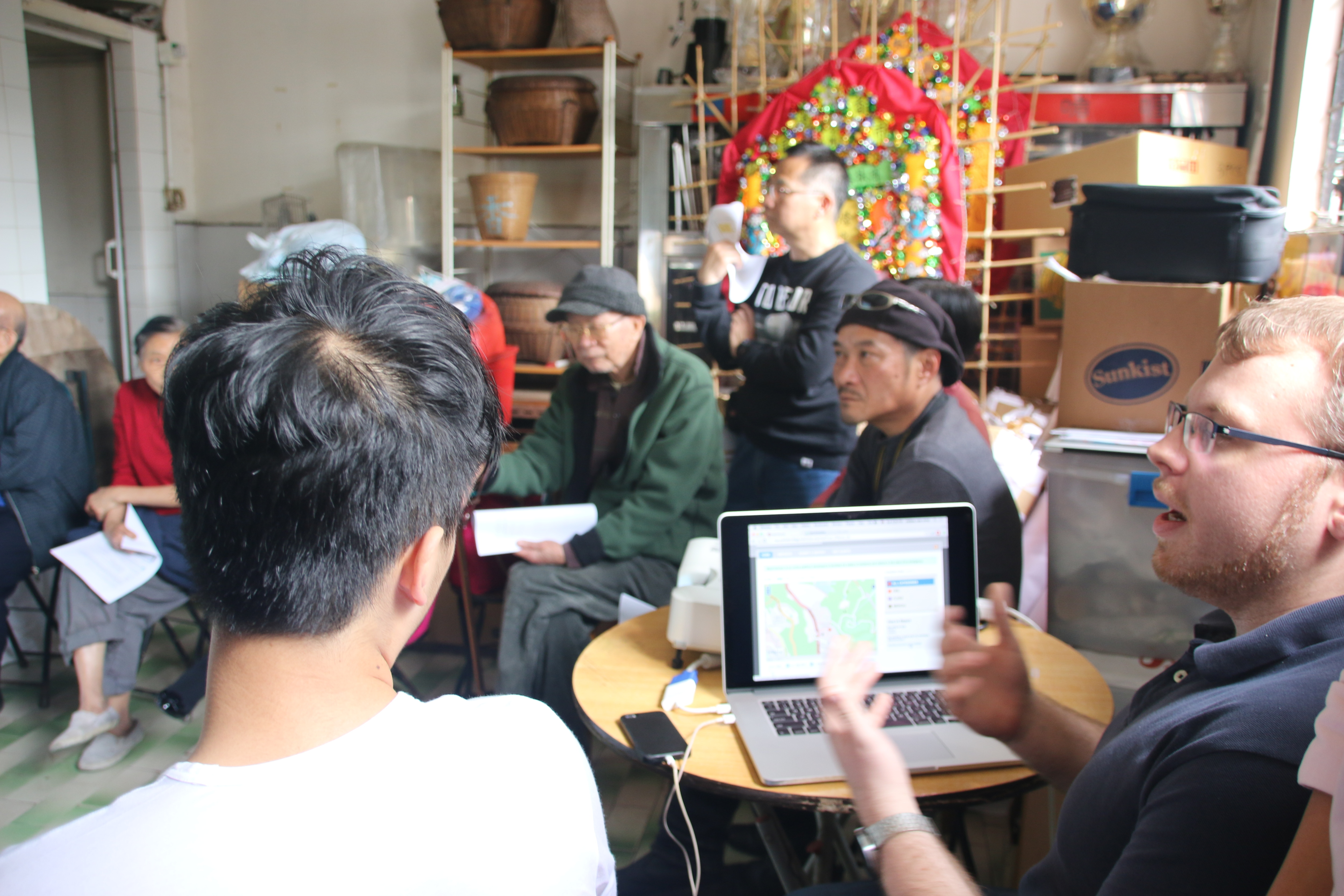
    #MapPokfulam: System Prototype Demo & Testing Workshop
    Sunday March 8, 2-4pm
    Old Restaurant, Main Street, Pokfulam Village

    The “MapPokfulam” Project develops a online platform for information exchange to facilitate the safety of residents and villagers in the case of an emergency. The first step of this process was mapping the village using the free and open source mapping platform Open Street Map. Please join us for a demonstration and testing of how to make a report using the Ushahidi platform and give your feedback as to the utility of the system and what else needs to be included in the map and the system itself. Check out the prototype at http://map.pokfulamvillage.com/
    mapPokfulammapPokfulam
    This community mapping project is supported by the Hong Kong Southern District Council and the Southern District Health and Safety Association in collaboration with Caritas and the Pokfulam Village Cultural Landscape Conservation Group, Pokfulam Villagers and university students.

    February 8, 2015
    #MapPokfulam Open Street Mapping workshop
    Sunday, February 8, 2-4pm
    Pokfulam Village Community plaza

    The “MapPokfulam” project develops a online platform for information exchange to facilitate the safety of villagers in the case of an emergency. The first step of this process is mapping the village using the free and open source mapping platform Open Street Map. Please join us for the first community workshop to learn how to take and upload tracings in OSM, as well add key features and points and edit the online map.
    Image credit: Jerome Favre/EPAmapPokfulammapPokfulam

  • articles

    Sidewalk Stories
    Melissa Cate Christ and Tom Oliver Payne
    Kerb 32: Unsaid

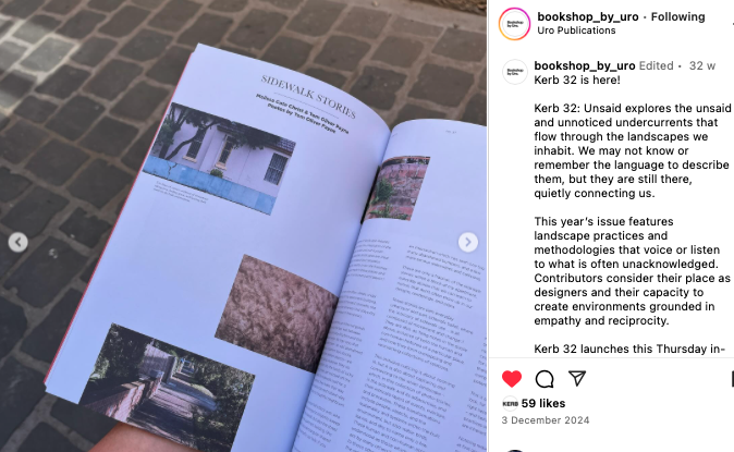
    Melissa and Tom are excited to announce the publication of their photo essay ‘Sidewalk Stories’ in Kerb 32: Unsaid. The text is complemented by Tom’s photographs of the Inner West neighborhood of Dulwich Hill. The aim of the piece was to document everyday moments which are often overlooked or unnoticed, but which provide a window to understanding the human and non human occupation of the places in which we live.

    More info about the issue, the other articles, and a link to purchase the magazine from Uro Publications can be found here.
    articles

    Documenting topographic ecologies in Hong Kong
    Recombinant Ecologies in the City
    Ed. by Ilaria Vanni and Alexandra Crosby, Visual Communication 2020-8 19(3), p. 391-414.
    Andrew Toland and Melissa Cate Christ

    We are pleased to announce that Documenting topographic ecologies in Hong Kong: visual methods for hyper-dense and hyper-topographic urban spaces in landscape architecture, an article written by Andrew Toland and Melissa Cate Christ, has been published. The article appears in Recombinant Ecologies in the City, a Special Issue of the journal Visual Communication (Volume 19 Issue 3, August 2020). The issue was edited by Ilaria Vanni and Alexandra Crosby. Please find the abstract below and the article (unfortunately closed access – get in touch if you would like access) here.
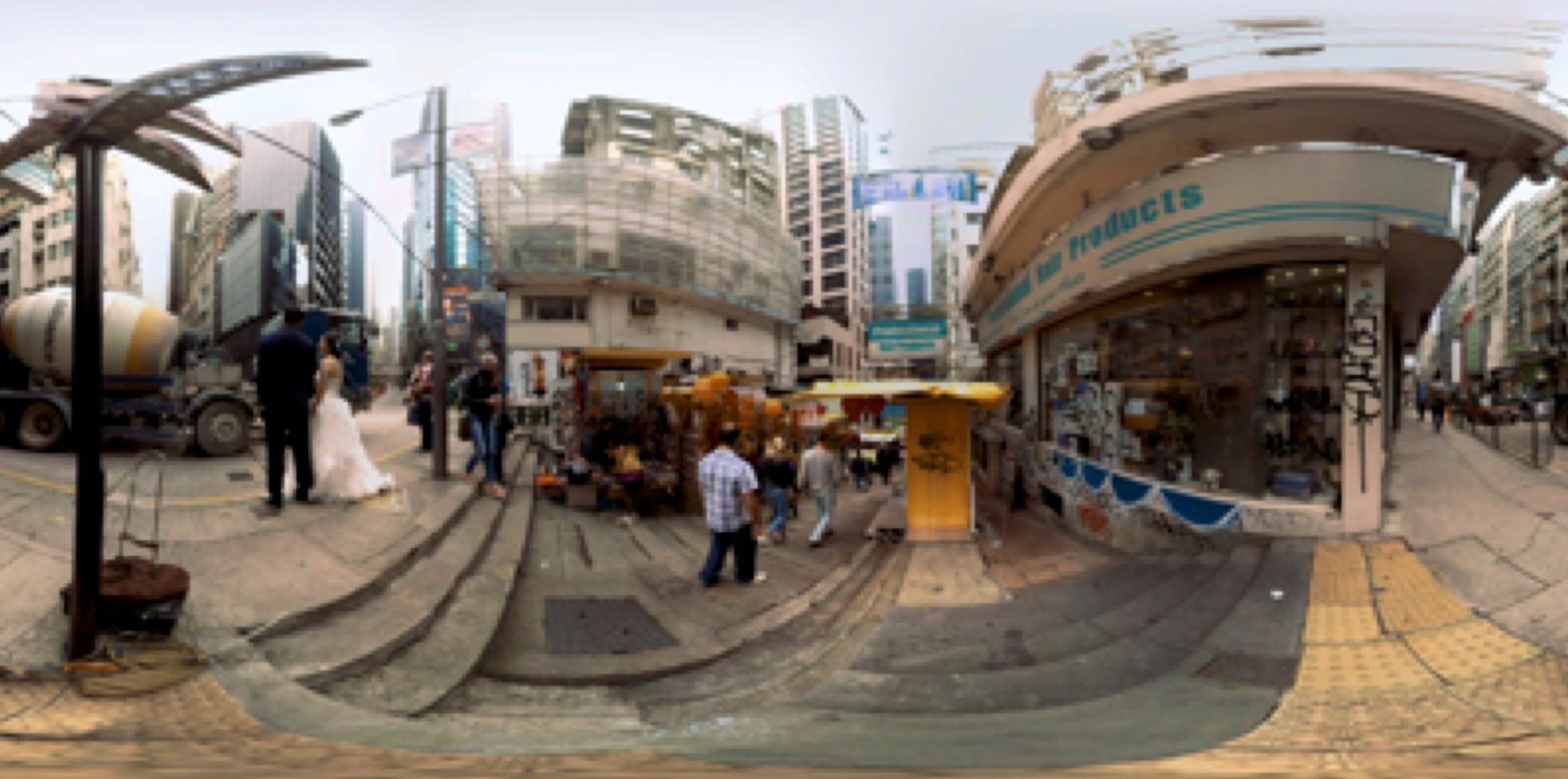
    articlesStill shot from Pottinger Street 360 film by Nicholas Buechi. © Nicolas Buechi.

    This article draws on experiments with techniques of visual documentation and representation in circumstances of topographic intensity in Hong Kong. Centrally, the authors ask: how can approaches to visual representation reveal or reframe assemblages of material and immaterial processes in hyper-dense and hyper-topographic urban landscapes? The shaping and reshaping of the ground are essential parts of the formation of recombinant ecosystems, especially in intensively built-up environments – the constant reconfiguration of materials and spaces continually brings into being new ecological conditions. However, the visualization and representation of these transformations are often absent from the repertoire of techniques used to map and understand urban processes. This article addresses how landscape architecture can continue to develop methods to record, represent, visualize and design recombinant ecosystems in our urban environments. It considers which tools and techniques might provide ‘thickened’ understandings of hyper-dense, small-scale and intensely topographic urban environments like Hong Kong, with the objective of assisting designers and planners develop new ways to understand and see public space that can address the human and more-than-human nuances of complex urban spaces over time.

    editorial
    A path to increasing food security in Hong Kong?
    Food sovereignty, food waste reduction, and local food production
    Ming Pao Weekly (in Traditional Chinese)
    November 21, 2016

    Melissa has published a short editorial in the Hong Kong magazine Ming Pao Weekly advocating for the need to address food insecurity in Hong Kong. The full text is below or you can read it online (in English) here. articles
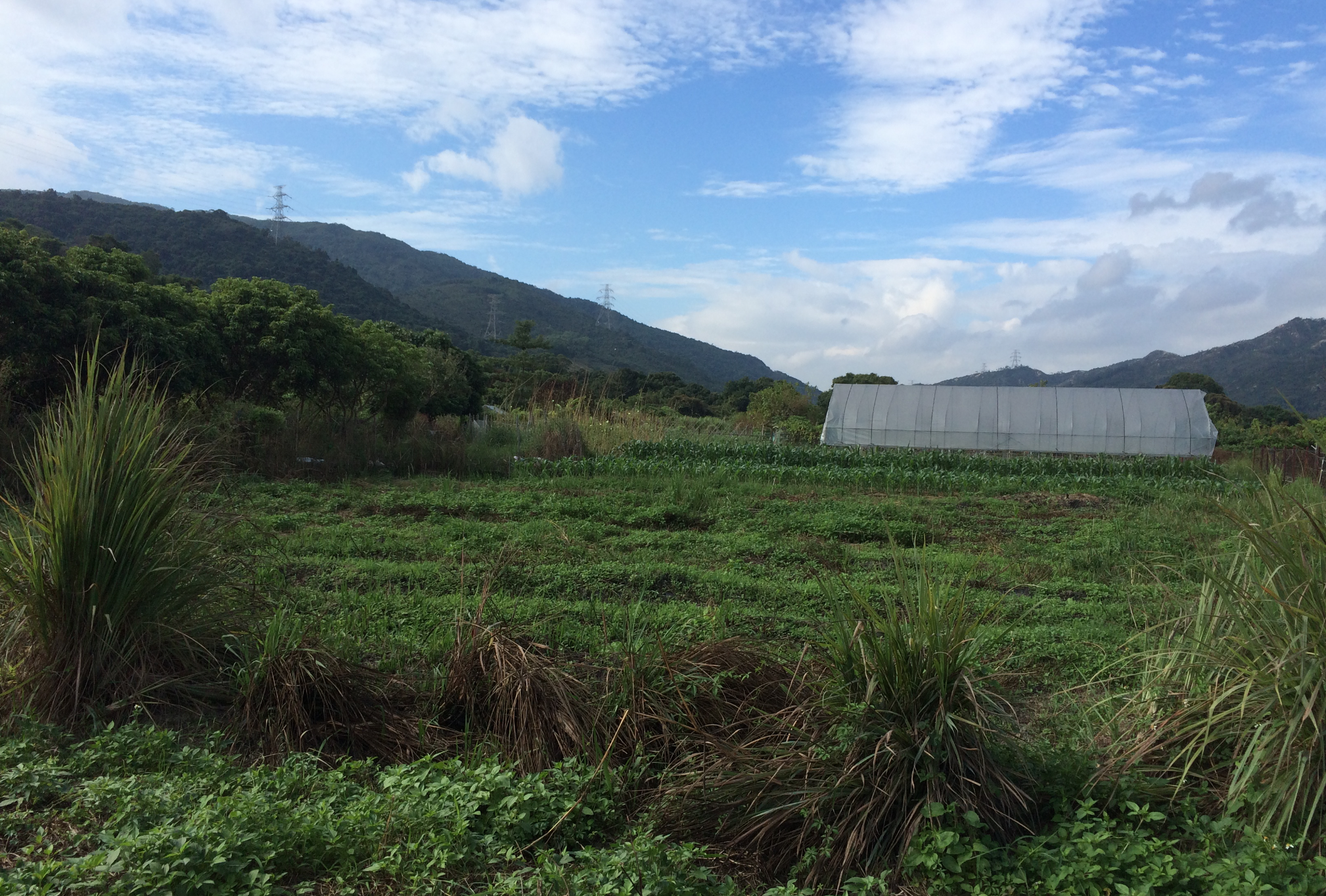
    Choi Yuen Farm Photo credit: Melissa Cate Christ

    Ranked high on Nomura’s 2010 Food Vulnerability Index (7th of 80 countries), and with 4.4% of GDP spent on food imports (the highest in the world), Hong Kong’s food security is an area of concern and focus by government bodies, academics, NGOs, and local businesses and entrepreneurs. Food security is defined as the right of “all people, at all times, [to] have physical and economic access to sufficient, safe and nutritious food to meet their dietary needs and food preferences for an active and healthy life” (FAO, 1996). The availability of food, either through local supply or imports, along with physical and economic access to food and the ability to utilize food both safely and nutritionally, are the three primary dimensions of ensuring food security.

    In Hong Kong, we rely on imports for over 90% of the food which our 7.2m people eat each year, putting the city at a high risk of food unavailability given conditions such as disaster events, climate change, population increase or political and social unrest that can restrict exports to reserve food for local populations, or disrupt supplies from international trading partners. Top importers include China, USA, Brazil and Japan, followed closely by Australia and France. These imports are distributed to over 14,000 food retail outlets, including over 9,000 wet market stalls.

    Although two supermarket chains (Welcome and ParknShop, with over 250 outlets each) account for 75% of all supermarket turnover, wet markets continue to play an important role in distribution and sales, but are losing sales to supermarkets, which are up to 54% of total retail sales in 2010 from 44% in 1995. However, considering that Mainland China provides 94% of the fresh pork, 100% of the fresh beef, 92% of vegetables and 66% of eggs consumed in HK, is food at a wet market actually any different than that bought at a supermarket? What choice do consumers really have? Is this reliance on imports and a supermarket duopoly sustainable? How much of that food is wasted along the food chain? How do these situations impact vulnerable populations, such as the 18% of residents who live below the poverty line? Can a focus on local production, food waste reduction, and food sovereignty, which is defined as “the right of peoples to healthy and culturally appropriate food produced through ecologically sound and sustainable methods, and their right to define their own food and agriculture systems” (La Via Campesina, 1996), address these questions and increase food security in Hong Kong?

    Although well established in the USA and Europe, support of local, organic food as a means to a self-sustaining, secure food supply, is relatively new in HK, given the statement in the December 2014 consultation document, “New Agricultural Policy: Sustainable Agricultural Development in HK”, that local agriculture is not a means of primary production. However, farmers and consumers are increasingly interested in locally produced, organic food either for direct purchase onsite, through farmer’s markets, in restaurants or through modified CSA programs such as Homegrown Foods. But with a total of only 2400 farms (540 classified as organic as of June 2015) on 700 hectares, 3800 hectares considered abandoned farmland and no accounting for the production of rooftop farms, local production was calculated as only 1.9% of fresh vegetables, 79.6% of live poultry and 6.1% of live pigs in 2014.

    The Fall 2014 speech by Secretary for Food & Health Dr Ko Wing-man acknowledged that “HK shares APEC’s goal of strengthening food security and fighting against the volatility of food prices”, however increasing the amount of local production was barely mentioned in the consultation document. It focused instead on a matching fund, establishing AgriParks and promoting local agriculture, not with targets for production increase (since a focus on quantity, rather than quality, would go against free market principles), but as a leisure activity that can provide employment and high quality, but low quantities of specialty foods through new technologies. This proposed focus does not acknowledge the potential risk of food unavailability and utilization due to the HK’s reliance on imports, especially from Mainland China, with its food safety issues, lack of hygiene standard enforcement, illegal and harmful food additives and the widespread use of chemical fertilizers and pesticides. These issues not only affect the food we eat but also impact the soil, air and water through agricultural run-off and air pollution from chemical manufacturing processes. Add to this cultural practices and inefficiencies in the food chain that lead to 3,337 tonnes/day of food being wasted (EPD, 2012) and ending up incinerated or in landfills, it becomes apparent that the current model of food supply in HK is not sustainable. It is time to support a food sovereignty approach, in combination with local production and food waste reduction, to increase food security in Hong Kong.

    editorial
    Car-free Sundays: A Hong Kong Edition?
    Ming Pao Weekly (in Traditional Chinese)
    March 29, 2016

    Melissa has published a short editorial in the Hong Kong magazine Ming Pao weekly advocating for the implementation of Car-free Sundays in Hong Kong. The full text is below or you can read it online (in English) here. Also see Yanni Chan’s piece for Hong Kong Magazine “Yes. We Can Have a Walkable Central” for a more in-depth look at the issue.
    {image 3articles}Umbrella Movement, October 2015 Image credit: Melissa Cate Christ
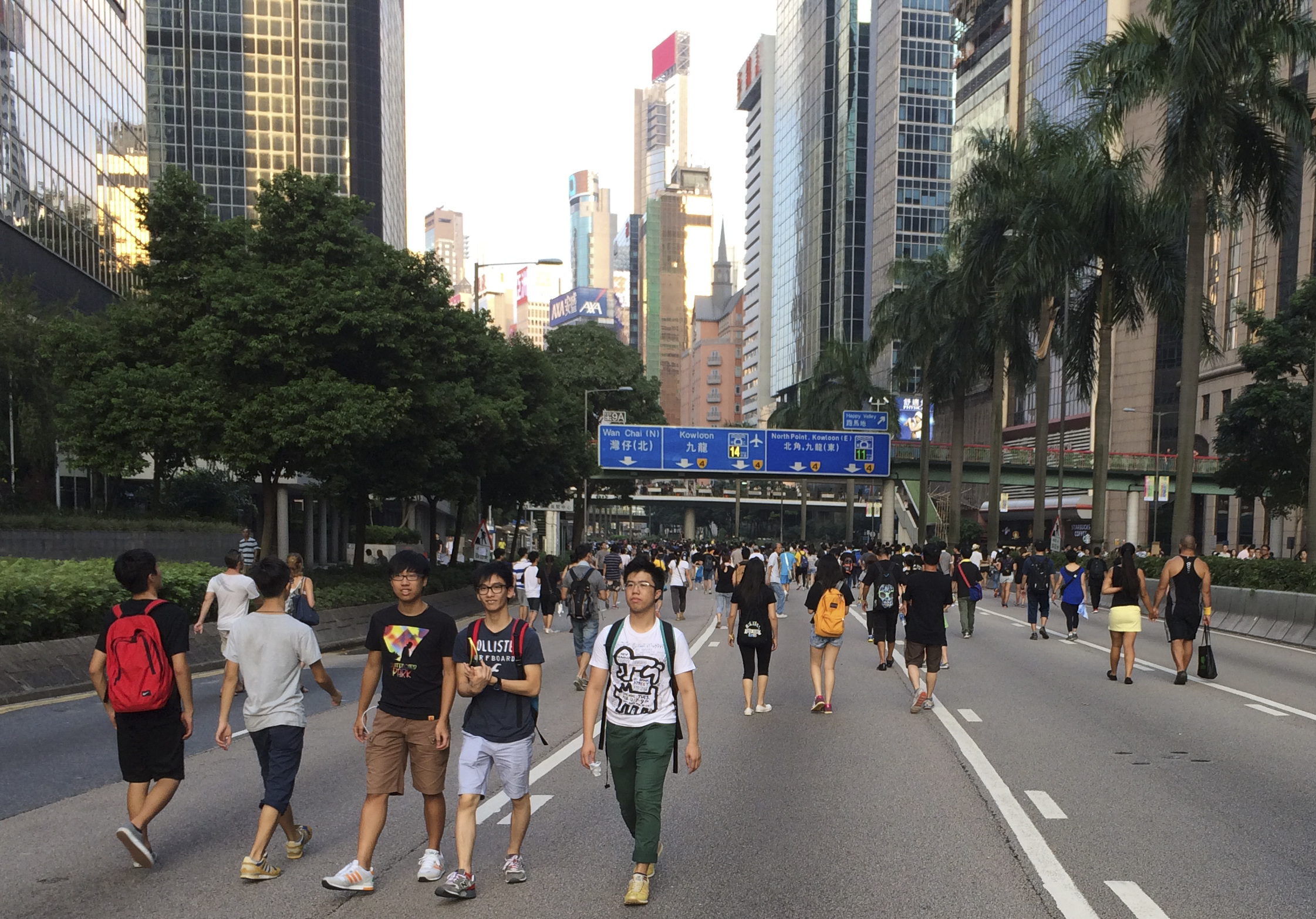
    Can we reoccupy and redesign Hong Kong’s streets to prioritize people over vehicles? It seems we can. For, as demonstrated by the transformation of key vehicular streets into dynamic pedestrian environments during the 2014 Umbrella Movement, Hong Kong’s urban landscape has the capacity to provide for the needs of a large number of people, from the essential to the environmental to the socio-political. Beyond evaluating the success or failure of the Movement’s political demand for ‘true universal suffrage’, the occupation reinvigorated a cultural awareness regarding Hong Kong’s perpetual spatial inequality and degraded living environment. The Umbrella Movement created a community, composed not just of those who support social and political equality, but also of those who support spatial equality and the possibility of prioritizing people over vehicles as a way to co-create a more liveable and sustainable city. The Movement’s tactical and nuanced occupation and traversal of spaces previously (and now, again) devoted to cars or restricted by rules and regulations to single uses can be seen as a provocative starting point to imagine strategies and tactics for the reprogramming of Hong Kong’s streets. One of those tactics is the re-implementation of car-free stretches of street or highway according to an internationally widespread practice, Car-free Sundays.

    The benefits of ‘car-free’ days in Hong Kong have already been proven. Blockading the streets during the Umbrella Movement was a tactic to force negotiation, but it also improved the environment in Hong Kong. Roadside pollution levels dropped over 40% during the protests according to the Clean Air Network, noise levels were significantly lowered and the closed streets became wide communal public spaces – giant sidewalks and plazas that accommodated every kind of pedestrian activity, from walking to skateboarding to eating to studying to sleeping. In addition to the environmental and social benefits, in Admiralty in particular, the ability to cross at grade and to walk or bike from Central to Causeway Bay, opened up a whole new logistical landscape and way to travel through the city which is faster, and more encouraging of a healthy, active lifestyle than the MTR, tram, bus, taxi or private vehicle.

    Can Hong Kong design its urban landscape to transform itself into a livable, healthy, walkable city? After this experiment in which a highway became a boulevard, and acknowledging the environmental and social benefits of pedestrianization, can we keep the momentum going to eventually transform Hong Kong’s streets and highways into ‘complete streets’, where safe access for all users is emphasized, where people are given priority over vehicles? In this future city, sidewalks are wider, fences are removed, crosswalks and signaled intersections are installed, roads are narrower, speed limits are lowered and space is made for benches, vegetation and chatting? All these are possible – if we can imagine Connaught or Nathan Road as a pleasant place to walk, other main thoroughfares (such as Caine or Garden Road on Hong Kong Island for a start) could be next.

    So to further test the viability of reducing traffic and to increase residents demand for a safe and healthy urban environment in Hong Kong, why not establish car-free Sundays? A weekly event would show Hong Kong’s commitment to improving the living environment of the city.Hong Kong’s public transit network is world famous for its investment model and efficiency, but in order to take the next step towards a sustainable future by reducing the speed, number and trips made by vehicles in the city, including buses, taxis and minibuses, people need to be able to walk, cycle and take other forms of non-motorized transport. Why not repeat every week what has already been shown during the Umbrella Movement: people want to walk from Central to Causeway Bay and that the cessation of vehicular traffic on those barricaded roads significantly improved air quality and significantly reduced noise pollution.

    There are precedents around the world for Car-free Sundays, including Jakarta, Seattle, San Francisco and Bogota. Hong Kong would have a number of models to choose from, some of which have led to the conversion of highways into boulevards and the implementation of permanent improvements which lowered speed limits and improved safety and air quality. In others, the closed or reduced streets act as temporary public spaces for festivals and gatherings, cafes, theatres or just chill-out spaces to meet and greet friends and family. With car-free Sundays, the people of Hong Kong would have the opportunity to connect with their neighbors and walk, bike, scoot, rollerblade, stroll, or dance in a pollution-free, spatially equitable environment. Occupying these spaces with people, rather than vehicles, is the first step towards making Hong Kong a truly equitable and liveable city. Its time for Car-free Sundays in Hong Kong.